The Kara Sea is located in the Far North of Russia and is the marginal sea of the Arctic Ocean. It is limited to the coast of Eurasia, Novaya Zemlya and a number of other islands. More than a dozen rivers flow into it, the largest of which are the Ob and the Yenisei. The first of them, when it enters the Kara Sea, forms the so-called lip or bay, a funnel-shaped mouth, the width of which increases as one approaches the sea. Part of the Gulf of Ob, the largest Gulf of the Kara Sea, in turn, is the Taz Bay. It got its name because of the river flowing into it called the Taz.
A brief description of this bay will be presented in the article.
General information
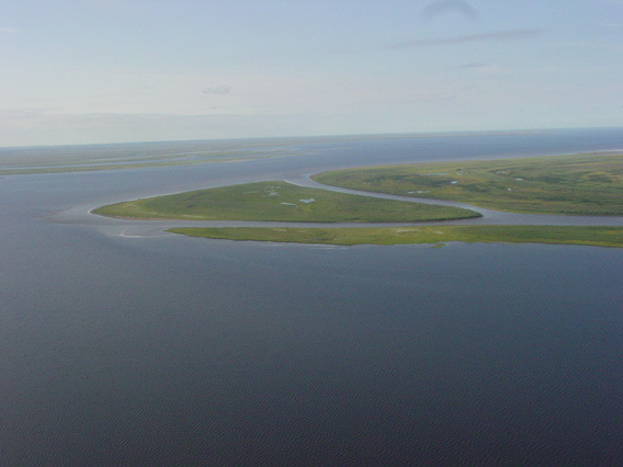
The Taz Bay (69 ° 05′00 ″ N 75 ° 45′00 ″ E) branches off from the Ob in its eastern part, at a distance of 250 kilometers from its delta, and is a flooded extension of the Pura and Taza rivers. The water in it is fresh. The width of the bay at the entrance to it is 45 kilometers, the average width is approximately 21 kilometers. The total length of the lip is approximately 330 kilometers, the total surface area is 6500 km 2 . The depth of the Taz Bay is small - up to nine meters. There are many underwater shallows. The bottom of the lip is silty, in some places - sandy.
Tazovskaya is separated from the Gulf of Ob by the peninsula of the same name. From the north and east it is bounded by the Gydan Peninsula.
What sea does the Taz Bay belong to? The answer is obvious: it, as part of the Ob, belongs to the Kara Sea. The largest river flowing into it is the Taz. It carries its waters through the territory of the Yamalo-Nenets Autonomous Okrug and has a length of 1,401 kilometers. In the lower reaches, it is navigable.
Other rivers of the basin
In addition to the Taz, the Salyakaptan, Pur, Antipayayayah, Messoyakha rivers flow into the Taz Bay (photos are given in the article). They are not so long and full of water. So, Salyakaptan has a length of only 68 kilometers. This river is a watershed between the two regions of the Yamalo-Nenets Autonomous Okrug - Purovsky and Tazovsky. On it passes the administrative border between them.
The Pur River, together with its component Pyakupur, has a length of 389 kilometers. Its catchment area has an area of 112,000 km 2 . Pur is navigable. On the right bank of Pyakupur is the city of Tarko-Sale, founded in 1932. Its population for 2017 was 21,665 people. Downstream the Pura are the settlements of Korotchaevo and Urengoy (7,000 and 10,000 people, respectively).
The length of Antipayayahi is 242 kilometers. It flows into the Taz Bay near the village of Antipayuta.
Flowing from east to west. The river basin area is 6640 km 2 .
Messoyakha is 466 kilometers long, and its catchment area is 26,000 km 2 . Its waters are clean enough, as it carries its waters away from industrial centers.
Natural conditions
The Taz Bay is located in the subarctic climate zone. The climate here is sharply continental. Severe frosty winter with frequent snowstorms reigns seven to eight months a year. Of these, a polar night takes at least a month. Winter temperatures are appropriate here: for example, in the basin of the Taz River, the thermometer can drop to -60 degrees. The average annual temperature is below zero (-6 ... -9 degrees Celsius).
Already in October-November, the rivers of this region are covered with ice, which opens only in May-June. The lip river basins are located in the natural zones of the forest-tundra and taiga. There are many sphagnum bogs in this area. In winter, the rivers flowing into the Taz Bay carry the so-called overseas water, which is poor in oxygen. This has an extremely negative effect on river inhabitants. Moreover, the overcast phenomena are most pronounced precisely in the Pur river, in fact, on the territory of its entire basin. They are most pronounced if there was a small amount of precipitation in the summer-autumn season, and the coming winter was not snowy.
On average, Pur is ice-free 128 days a year. Zamora are characteristic of the entire south of the lip, right up to the Pivotny metro station.
The nature of the Taz Bay: fauna and flora
The banks of the lips were covered with moss and lichen-moss, dwarf birch and willow. The waters of the Taz Bay and its rivers are rich in phytoplankton, which has not yet been fully explored. But it is already known that it has in its composition more than 170 species of algae belonging to seven departments. Among them, diatoms and greens predominate.
Small mollusks, such as valvata, pisidium, spherium, small crustaceans, small-bristle worms, etc. live in the waters of the Taz Bay. Non-frozen places are the wintering area for many fish species, and the entire lip area is a growing area for their fry. Ruff and burbot live here. Populations of smelt, whitefish, vendace, ide, lamprey, muksun, chira, peled, as well as nelma and sturgeon (in smaller quantities) are of commercial importance. In total, there are 32 species of ichthyofauna in the Taz Bay.