The Mogilev region is the easternmost region of Belarus, bordering the Russian Federation. In the north, it borders with Vitebsk, in the south - with Gomel, in the west - with Minsk. The eastern neighbors are the Bryansk and Smolensk regions of Russia. More than 37 percent of the territory is occupied by forests, 50 percent is farmland. The map of the Mogilev region presented in the article clearly demonstrates the outlines of this region of Belarus.
History of the region
According to archaeological data, the first people lived on the Ola River since the Stone Age. And at the village of Bolshoi Bortniki, archaeologists managed to find perfectly preserved household objects and tools made of bone and horn in peat deposits. This gives an idea to historians about how people lived four to five thousand years ago. During the time of Kievan Rus in the Mogilev region (it was part of this state), the first cities that still exist today appeared on the banks of the Dnieper: Mstislavl (founded in 1135), Krichev (1136), Propoisk, modern name - Slavgorod (1136) ), Mogilev (1267). In the period from the 12th to the 16th century, this region was part of the Grand Duchy of Lithuania, Russian and Zhemoytsky. At this time, cities grew significantly, they became major centers of trade. Warriors of the Mstislavl gonfalons forever inscribed their names in the history of Europe, having survived in a bloody battle in 1410 against the knights of the Teutonic Order at Grunwald. Starting from the middle of the 16th century, these lands became part of the Commonwealth. During the Russo-Polish war, the population of the region was halved. And during the confrontation with the Swedes in the area of the village of Lesnaya, an important battle took place, which ended with the victory of the Russian army. During the partition of the Commonwealth, these lands became the property of Russia. Empress Catherine II gave Prince Potemkin the city of Krichev, and Golitsyn - the city of Propoisk. During the Russo-French War, Mogilev region became an arena of military operations, and during the First World War there was the headquarters of the last Russian Tsar Nicholas II.
Mogilev region was founded in January 1938. During the Second World War, Soviet soldiers held Mogilev from the onslaught of the German invaders for 23 days. In this war, the region lost a quarter of its population.
Region population
1 million 76 thousand people live in the Mogilev region. Of these, more than 75 percent - in cities and towns, the rest - in villages and villages. Almost 90 percent of the population is Belarusians. The following national minorities live in the region: Russians (132 thousand people), Ukrainians (21.1 thousand), Jews (3.5 thousand), Poles (2.8 thousand), Armenians (1.1 thousand). As well as Tatars, Gypsies, Lithuanians, Azerbaijanis, Germans and Moldavians.
Religion
There are 17 religions in the region, the main one is Orthodox Christianity. In general, Belarus (the Mogilev region is no exception) is characterized by loyalty and tolerance for various religious faiths. Here mosques, churches, Christian churches and many others coexist with ease. So, in the region there are 157 different religious communities. Of these, 69 - the Orthodox Christian Church, 29 - Evangelical Christian Baptists, 17 - the Roman Catholic Church, 6 - the Old Believer Church, as well as other Christian movements. In addition, there are Jewish, Muslim, Hare Krishna communities.
Settlements and areas of the Mogilev region
This region (total area is 29.1 thousand km 2 ) is divided into administrative regions. There are 21 of them: Belynichsky (an area of 1419 square kilometers), Bobruisk (1599), Bykhovsky (2263), Glussky (1335), Goretsky (1284), Dribinsky (767), Kirovsky (1295), Klimovichsky (1543), Klichevsky (1800) , Krasnopolsky (1223), Krichevsky (778), Kruglyansky (882), Kostyukovichsky (1494), Mogilevsky (1895), Mstislavsky (1333), Osipovichsky (1947), Slavgorod (1318), Khotimsky (859), Chausky (1471) , Cherikovsky (1020), Shklovsky (1334).
Osipovichi, Bobruisk, Kirovsk, Mogilev, Shklov, Bykhov, Gorki, Chausy, Slavgorod, Cherikov, Mstislavl, Krichev, Kostyukovichi, Klimovichi are the cities of the Mogilev region. The administrative centers of the region are fifteen cities, six urban-type settlements. In addition, it consists of three workers' villages, 194 village councils. In total, villages and villages of the Mogilev region account for 3,120 settlements.
Transport connection
Belarus is an important transit route between Europe and the Russian Federation, and the Mogilev region is characterized by a developed road infrastructure. Railway junctions directly connect it with all regions of Belarus, with Moldova, Ukraine, the Baltic countries, as well as with a number of regions of Russia. In addition, the region has direct bus connections to Novogrudok, Gomel, Vitebsk, Orsha, Minsk, Novopolotsk, St. Petersburg, Smolensk, Moscow and others. In addition, the middle reaches of the major waterways of Europe, such as Sozh, Berezina and the Dnieper, cross this region.
Industry
The Mogilev region is one of the main industrial regions of Belarus. It is represented by more than 240 enterprises. The region holds the first positions in the production of underground trains and self-propelled scrapers, passenger elevators, trailed agricultural machinery in the CIS countries. In Belarus, the Mogilev region is the main manufacturer of tires, centrifugal pumps, cement, electric motors, soft roofs, textile haberdashery, dressings, silk fabrics, rubber shoes and more. The main industrial centers are Bobruisk and Mogilev. The latter is home to the Mogilev industrial park and the free economic zone.
Natural resources
The Mogilev region is very rich in minerals and natural resources. More than 1800 deposits are known here, including cement raw materials (the largest reserves of marl, clay, chalk and cement loams in the country), phosphorites (unique to Belarus), sand and gravel mixtures, building and silicate sands, peat, sapropels, mineral waters, Tripoli (the largest in the country) and oil.
Agriculture
Agricultural lands of the region occupy more than 50 percent of the territory, including arable land (33.1 percent), pasture (9.1 percent), and hayfields (8.1 percent). The leading role in the agricultural sector of the region is crop production. Legumes and grains are ubiquitous. On 70 percent of the area they produce feed grain and on 30 percent - food. Livestock farming is mainly in the milk and meat sector. A number of districts of the region contain specialized farms that are engaged in raising fur animals, horses, and fish production. One of the most important environmental problems here is radioactive contamination after the accident at the Chernobyl nuclear power plant in 1986. In total, about 35 percent of the territories are polluted.
Culture
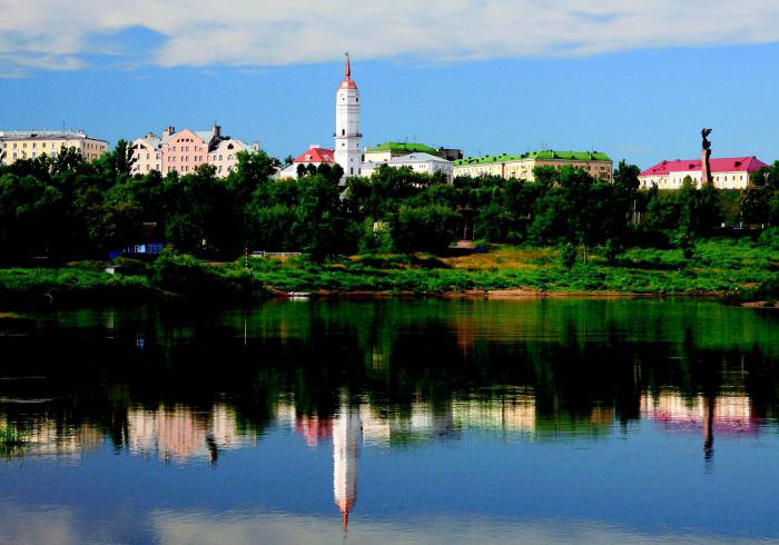
The rich history and artistic culture of the region is reflected in many monuments of archeology, decorative and applied and monumental art, and an original architectural heritage. Among the main attractions, there are 27 museums, three professional theaters and a philharmonic society. In the Mogilev region, several international theater and music festivals are held annually. Three regional and 21 local newspapers are published in the region. There are city and regional television and radio channels.