The geographical location of the Caucasus is still controversial among scientists. After all, the border between Europe and Asia runs along it. But where exactly does this cordon lie? If we assume that the southern foothills, then the highest point in Europe is Elbrus. But if the border passes along the Main Caucasian Range, then Mont Blanc. This mountainous country is very long. In different parts of the Caucasus has developed its own climate. These zones differ in relief and nature. In this article we will talk in detail about the many-sided mountain system of the Caucasus.
Location on a geographic map of the world
This region is located in Eurasia, between the Black and Azov Seas in the west and the Caspian Sea in the east. To the north of the Caucasus stretches a spacious East European Plain. This large mountainous country has its distinct natural borders. The geographical position of the Caucasus between the two seas of the Atlantic Ocean and the largest in the world inland lake Caspian determines that the western and eastern borders of the mountain system are clearly visible. But as for the northern and, especially, southern, everything is not so simple. The Kumo-Manych depression lies in the territory from the Caspian Sea to the Azov and the Kerch Strait. It is considered the northern border of the Caucasus. In the south, this system smoothly passes into the mountains of Turkey and Iran. The border can be conditionally drawn along the former state cordon of the USSR in this region. Now these are the borders of Georgia, Armenia and Azerbaijan. The southern border runs along the Armenian Volcanic Highlands, the Araks River and approaches the Talysh Mountains.
On a geotectonic map
The geographical position of the Caucasus eloquently suggests that this mountain system is part of the Alpine-Himalayan belt. Tectonic activity is still ongoing here, although there are no active active volcanoes. By geomorphological construction, the Caucasus is divided into four orographic regions. Let's look at them in a row.
In the very north is the Pre-Caucasus plain, which stretches in a wide strip from the Sea of Azov to the Caspian Sea. Further south, low hills give way to mountains. On the Greater Caucasus Mountain Range, the main peaks of the system are located - Elbrus and Kazbek. This vast region also has its own characteristics. South of it is the Transcaucasian depression. It includes the Kura-Araksin and Colchis lowlands. They also alternate with the Transcaucasian Highlands. It, in turn, is divided into two parts. This is the mountain system of the Lesser Caucasus and the Javakheti-Armenian Highlands.
On the political map of the world
South of the Main Caucasus Range are independent and sovereign states of Georgia, Armenia and Azerbaijan. The north of the mountain system is occupied by the Russian Federation. There are also unrecognized republics of the Caucasus: South Ossetia, Abkhazia and Nagorno-Karabakh. Their future, as well as their current political status, is very vague. The Russian Federation has several territorial entities in the region. In the northwest it is the Stavropol and Krasnodar Territories. They are generally recognized resort regions of Russia. Such autonomous republics of the Caucasus as part of the Russian Federation, such as Adygea, Ingushetia, Dagestan, Kabardino-Balkaria, Chechnya, North Ossetia and Karachay-Cherkessia, are located in the northeast. The national composition of the population in these countries is quite variegated. This is the occasion for various interethnic conflicts. Hot spots in the Caucasus were Chechnya, South Ossetia, Dagestan, and Ingushetia. Nagorno-Karabakh is still a disputed territory between Armenia and Azerbaijan.
Regions of the Caucasian mountain system
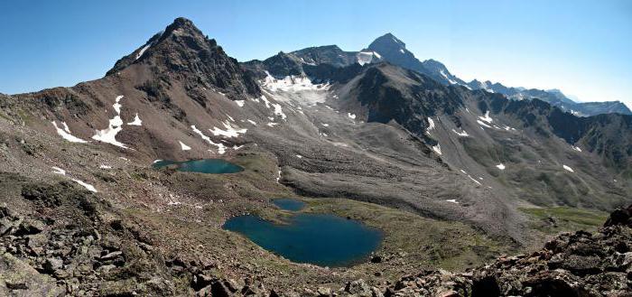
The enormous extent of the ranges also determined that each part of them has its own geographical features. Thus, the mountainous country can be divided not only into the northern, central and southern, but also into the Eastern and Western Caucasus. If we look at the Main Range, then we can isolate the part that begins on the Absheron Peninsula and rises to Kazbek. This is the Eastern Caucasus. The central zone of this massif is highly compressed, the Dividing Range (Main) and Bokovoy are separated by the northern and southern parts of the country. And the Western Caucasus begins on the Taman Peninsula and gradually rises to Elbrus (5642 m above sea level). In the small central part, between the two highest peaks of the mountain system, all the other five-thousandths are concentrated: Dykhtau, Mizhirgi, Dzhangi-tau, Pushkin, Koshtantau, Shkhara. Each of them is higher than the Mont Blanc mountain in the Alps (4807 m).
Lesser Caucasus
To the south of the Main (Dividing) Range, a significant depression of the relief runs from sea to sea. Here, such regions of the Caucasus stand out as the humid Colchis Lowland in the west and the arid Alazan and Kura-Araksin plains in the east. But south of these troughs the mountains rise again. Only the submeridional Likh Range connects the Greater Caucasus with the Lesser. The name of the latter should not mislead anyone. Of course, the peaks of the Lesser Caucasus are inferior to Kazbek and Elbrus. But here is Mount Ararat (5165 m). She is the highest point of Asia Minor. There are many peaks in this region above the Alpine Mont Blanc. The Lesser Caucasus bent over a 600-kilometer arc. Many of its ridges have a height of 2-3 kilometers. They are separated by deep intermountain basins. The vast Javakheti-Armenian highlands stretched south of these ranges. It consists of volcanic ridges and plateaus indented by deep canyons. The highest point of this region is Aragats (4090 m).
Where the mountain system ends in the south
The geographical position of the Caucasus is such that it is rather difficult to determine its border. In the southeast, the ranges gradually pass into the Talysh mountains, ending in the Lankaran lowland near the Caspian itself (28 m below sea level). In the south and southwest, the Lesser Caucasus passes into the Elburs Range. This chain in northern Iran is part of the Pontic Mountains in Asia Minor. Thus, we can say that the southernmost border of the mountain system is the Lankaran Lowland, the Talysh Mountains and the Elburs Range.
Peoples of the Caucasus
This region is inhabited by about fifty ethnic groups. And each of them has created its own distinctive culture. Particularly heterogeneous in ethnic composition is the North Caucasus (Russia). This region is inhabited by Kabardians, Adyghe, Circassians, Shapsugs, Chechens, Ingush, Batsbians, Tsakhurs, Tabasarans, Rutuls, Lezgins, Laks, Dargins, Aguls, Avars. There are also ethnic groups who speak the dialects of the Altai language family. These are Nogais, Trukhmens, Kumyks of Karachais, Balkars, Meskhetian Turks. Georgians, Armenians, Azerbaijanis inhabit Transcaucasia. But the national composition of these republics is also heterogeneous. Among the representatives of the titular nations of these countries there are Abkhazians, Ossetians, Tats, Talyshs, Mountain Jews, Yezidis, Kurds, Assyrians. And finally, newcomers who have settled in this mountainous region for a long history. These are Russians, Ukrainians, Greeks, Jews, Tatars and others. The main religions are Islam (both Shiite and Sunni branches) and Orthodox Christianity.
Seismic environment
The territory of the Caucasus lies entirely in the Alpine-Himalayan belt. This zone is very mobile. Therefore, earthquakes are frequent in the Caucasus. The increased seismicity of the region is also due to the fact that mountains due to the convergence of tectonic plates grow by one and a half centimeters per year. At the same time, the lowlands are even lower. This process is not so fast - from two to six millimeters per year. The most frequent earthquakes in Transcaucasia, and more precisely in the north-west of the Armenian Highlands. The last such natural disaster, which claimed thousands of lives, occurred in 1988. The mountain Caucasus, due to its increased seismicity, is prone to frequent avalanches, glaciers and mudflows. Small earthquakes cause rockfalls and landslides. Soft sedimentary rocks are washed away by flows and other erosion processes. Thus, karst caves are formed. They are especially numerous in the northern part of the Greater Caucasus. It is enough to recall at least the Vorontsov system of caves, the New Athos, the Snowy Abyss (its depth is 1370 m), the Lago-Naki plateau.
Climate of the Caucasus
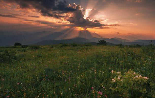
This mountainous country lies on the borders of subtropical and temperate natural zones. We can say this: the high wall, which is the Caucasus, in itself serves as a climate-forming factor. Five-thousandth peaks reliably shelter the southern slopes from cold winds. At the same time, the northern foothills of the Caucasus takes the whole blow of low temperatures. A particularly striking difference in climatic characteristics is observed in winter. When heavy snow falls in the Russian part of the mountainous country, clear, dry and warm weather reigns in the republics of Transcaucasia. Of course, in such huge mountains, altitudinal zoning is also observed. Snow peaks all year round. Below the zone of lichens and mosses is replaced by alpine meadows, coniferous and deciduous forests. And in the valleys lush evergreen subtropical vegetation pleases the eye.
Rivers of the Caucasus
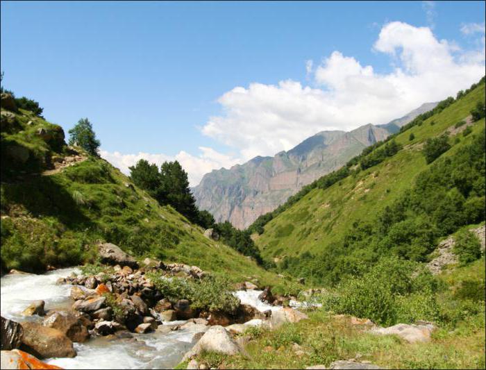
The water arteries of the region are mountainous in nature, and therefore play a large role in the energy sector. It should be said that to the north the slopes of the Caucasus are gentle, elongated, while the southern ones are steep and steep. Such a relief affects rivers. In the northern part of the mountainous country they acquire a flat character. An example is Don. Kuban is the largest river in the North Caucasus. But there are fast and turbulent water flows in this region of the mountainous country. This is primarily the Kura and Terek. The rivers of the Caucasus belong to the basins of the three seas that wash the mountainous country. Terek, Araks, Kura, Kuma and Sulak flow into the Caspian. Such water arteries as Bzyb, Kodori, Inguri, Rioni belong to the Black Sea basin. Azov is fed by Don, Kuban. The largest lake in the region is Sevan.
The nature of the Caucasus
The mountainous country surprises with a variety of landscapes. There are low-lying subtropical swamps, dense fir forests, boxwood groves, alpine meadows. At a considerable height of more than three thousand meters, lichens and mosses prevail. Permafrost begins at 3,500 meters above sea level. The northern foothills of the Caucasus are cooler. The vertical zonation on these slopes is characterized by a sharp change of zones. The border of snow in the North Caucasus lies lower than in the south - at around 2,800 meters above sea level. The mountain fauna of the region needs protection. Lynx and Caucasian leopard are on the verge of extinction. And the local species of bison, moose and tigers have completely disappeared. But still bears, boars, chamois and argali are found in mountain gorges. As for the flora, the Caucasus is known as the birthplace of a giant hogweed. In 1890 he was taken to Europe as an ornamental plant. Since then, he is considered an extremely dangerous and aggressive neophyte.
Recreational opportunities of the Caucasus
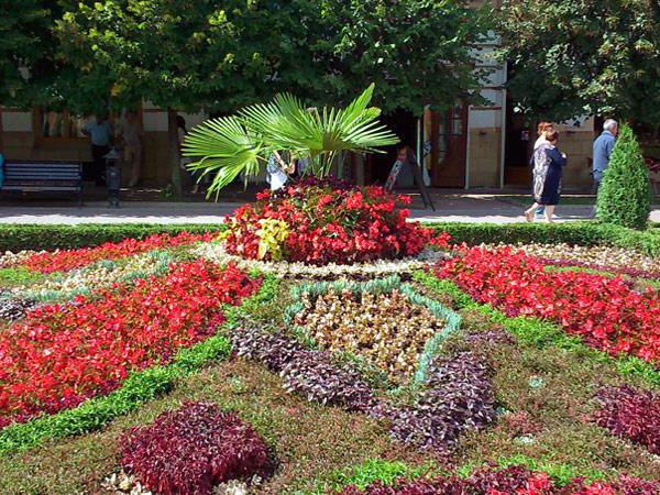
The region is located between the three southern seas. A mild climate has been established here, transitioning from temperate to subtropical. High mountains create a wide variety of landscapes. Fast rivers seem to invite you to go rafting. All this makes the Caucasus a recreational region. But here you can not only relax, but also heal. This is facilitated by the large amount of mineral water that is formed in the rocks. The whole world knows the Borjomi brand, which Georgia exports. But the North Caucasus is not lacking in recreational resources . Kislovodsk, Mineralnye Vody, Georgievsk, Zheleznovodsk, Pyatigorsk, Essentuki, Lermontov - all these resort towns are located in the Stavropol Territory. The Zolsky District (Kabardino-Balkaria) is famous for the Valley of Narzans and the healing mud of Lake Tambukan.