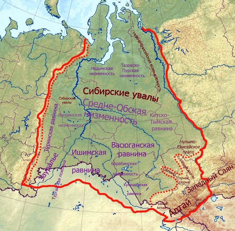
The Ishim plain is sometimes called the Ishim steppe in Russia. And in Kazakhstan - the North Kazakh plain. It is composed of lake-alluvial deposits, as it is located between two large water arteries: Tobol and Irtysh.
The Ishim Plain on the map of Russia is a unique section of the large West Siberian Plain. From the south it is bordered by small mountains of the Kazakh small hills. In the west it is bordered by the vast Tobol valley, and in the east - the Irtysh. In the southeast, the Ishim plain gradually passes into Pavlodar. And in the north, going down, it passes into the Central Irtysh lowland.
Relief: height above sea level of the Ishim plain
The relief of this steppe is a flat lowland with weak dissection and small maximum heights of up to 140 meters. The Ishim plain has a slight slope in the eastern direction. The relief is also characterized by shallow hollows that have remained from ancient rivers and streams.
There is also a stock valley on its territory, which is called the Kamyshlovsky Log. A fairly full-flowing Ishim River flows smoothly across the plain . In some places, the surface of the steppe has depressions, which are called depressions. They often have shallow lakes or extensive swamps.
Climate
In the forest-steppe part of the plain, the difference in daily and annual temperatures is great. Winters are cold and severe, the average January temperature is from -18 to -20 degrees. Minimum temperatures reach -52 degrees. It is warm in summer, the average July temperatures range from +18 to +19 degrees, but there is also forty-degree heat.
In summer, cyclones bring moisture to the plain. From 300 to 400 millimeters of precipitation falls annually, most during the summer: from 250 to 300. In winter, up to 45 centimeters of snow falls, this is relatively little, in addition, it lies unevenly on the plain. Therefore, the soil here freezes up to 1.5 meters.
In the steppe zone, high temperatures in summer combined with dry winds make these territories very arid. Cereal crops in the fields suffer from severe drought every three years and grow poorly, despite a longer growing season than in the forest-steppe zone. The annual rainfall is less than 300 millimeters. In Kustanai - 252 millimeters, and in Pavlodar - 260. The largest amount of precipitation falls in the summer, for a month 35-40 millimeters. Despite this, very strong evaporation occurs due to winds (85-90 percent of annual precipitation) and the soil loses a large amount of moisture. Sometimes there are phenomena such as dry winds in combination with a dust storm. The temperature sometimes rises to 40 degrees, and the soil heats up to 65.
Winter in the steppe is long and cold. The average temperature in January is from 16 to 22 degrees of frost, but it happens on some days the temperature drops to -40 and -50 degrees. Snow falls late, and in the first half of the winter period its thickness reaches only 16-30 centimeters. Snow cover lies steadily from 130 to 160 days a year. Spring comes late, does not last long, there is little rainfall in this period. Autumn is also short and dry in the first months.
Rivers and lakes
Ishim and Irtysh flow in the developed valleys; flood meadows are located in their floodplain. The tributaries of these two rivers are small, they have little water and in the summer they often dry up.
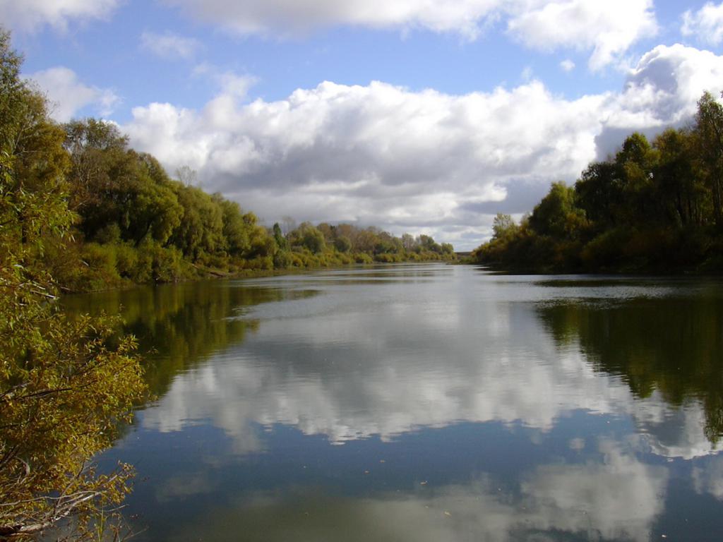
But on the Ishim plain there are a lot of rivers, shallow lakes and swamps. The rivers here are calm, slowly flowing along the steppe, since the slopes are very small. Therefore, their channel coils strongly. In the wide floodplains of the rivers , lakes-elders are often found. The formation of water arteries on the Ishim plain is impeded by drainage-free and numerous basins. They absorb all surface and ground waters. Numerous lakes appear due to these landforms - hollows and depressions. But these fresh water bodies are gradually overgrown with mud and swamp along the banks. All flat areas of the watersheds become swamps: all kinds of depressions, hollows, depressions and rear sections of river terraces. The swampiness of the Ishim Plain is gradually decreasing from north to south. Marshes occupy a smaller area and pass from sphagnum to sedge-hypocarpous.
Seleteniteniz Lake on the Ishim Plain (Kazakhstan)
The largest inland salt lake Seleteniteniz is located on the North Kazakh plain. This body of water is located at the bottom of a large depression located at an altitude of 64 meters above sea level. Its area is 750 square kilometers. The average depth is from 2 to 2.2 meters, and the maximum is 3.2 meters. This steppe reservoir is nourished by melting snow.
The coastline is uneven, heavily indented, and forms many bays and peninsulas. The eastern and northern shores rise above the lake, and the lowlands (western and southern) gradually turn into salt marshes and swamps. In spring, in the flood, the Sileti River flows into the lake. Two rivers constantly replenish the reservoir: Zholaksay and Kashirbay.
Vegetation
Kolkovo-steppes occupy most of the territory. This zone of the Ishim plain on the map of Russia stretches along the Trans-Siberian Railway between Chelyabinsk and Omsk. To the south, the feather-grass steppes called the Kustanai and Ishim steppes already begin. And further closer to the Irtysh is lowland.
Dark chestnut soils and chernozems with solonchaks prevail. 90 percent of the territory adjacent to the Irtysh and Ishim are plowed up. In the wild grow:
- feather grass;
- steppe tulips;
- bow;
- fescue;
- thyme;
- zopnik;
- sagebrush;
- irises.
Wormwood, saltmoss, licorice, chia, clover species and other plants resistant to salinization of the soil grow on the salt marshes of the Ishim steppe. In more humid places of the steppe, such shrubs as honeysuckle, acacia, dog rose, and spirea are found. Birch spikes also come across. In the river valleys there are light pine forests.