The territory of the Far East of Russia is a geographical area that includes areas in river basins that flow into the Pacific Ocean. This includes the Kuril, Shantar and Commander Islands, the islands of Sakhalin and Wrangel. This part of the Russian Federation, as well as some cities of the Russian Far East will be described in detail below (a list of the largest will be given in the text).
Population
The territory of the Russian Far East is considered the most depopulating in the country. About 6.3 million people live here. This is approximately 5% of the total population of the Russian Federation. During 1991-2010, the number of inhabitants decreased by 1.8 million. As for the population growth rate in the Far East, in the Primorsky Territory it is –3.9, in the Republic of Sakha –– 1.8, EAO –– 0.7, Khabarovsk Territory –– 1.3, in Sakhalin –– 7.8, in Magadan Oblast –– 17.3, Amur Oblast. - 6, Kamchatka Krai - 6.2, in Chukotka - 14.9. If current trends continue, Chukotka will be left without a population after 66 years, and Magadan - after 57.
Subjects
The Russian Far East covers an area of 6169.3 thousand kilometers. This is about 36% of the whole country. Often Transbaikalia is referred to the Far East. This is due to its geographical location, as well as the activity of migration. The following regions of the Far East are administratively distinguished: Amur, Magadan, Sakhalin, Jewish Autonomous Regions, Kamchatka, Khabarovsk Territories. Primorye Territory, Chukotka Autonomous Okrug are also part of the Far Eastern Federal District.
History of the Russian Far East
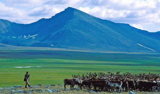
In the 1-2 millennium BC, the Amur region was inhabited by various tribes. The peoples of the Russian Far East today are not as diverse as they were in those days. The population at that time consisted of Daurians, Udegeans, Nivkhs, Evenks, Nanais, Orocs, etc. The main occupations of the population were fishing and hunting. The most ancient settlements of Primorye, which belong to the Paleolithic era, were discovered near the Nakhodka district. In the Stone Age, Itelmens, Ainu and Koryak settled on the territory of Kamchatka. By the middle of the XIX century, Evenks began to appear here. In the XVII century, the Russian government began to expand Siberia and the Far East. 1632 was the year of foundation of Yakutsk. Under the leadership of Cossack Semyon Shelkovnikov, a winter hut was organized on the coast of the Sea of Okhotsk in 1647. Today at this place is the Russian port - Okhotsk.

The development of the Russian Far East continued. So, by the middle of the XVII century, explorers Khabarov and Poyarkov went south from the Yakutsk prison. On
the Amur and Zeya
rivers, they clashed with tribes that paid tribute to the Chinese Qing Empire. As a result of the first conflict between the countries, the Nerchinsk Treaty was signed. In accordance with it, the Cossacks needed to transfer to the Qing Empire areas formed on the lands of the Albazin Voivodeship. In accordance with the agreement, diplomatic and trade relations were determined. The border under the agreement passed in the north along the river. Gorbitsa and the mountain ranges of the Amur basin. Uncertainty remained on the coast of the Sea of Okhotsk. The territories between the Taikansky and Kivun ranges were unbounded. Towards the end of the 17th century, Russian Cossacks Kozyrevsky and Atlasov began research on the Kamchatka Peninsula. In the first half of the 18th century, it was incorporated into Russia.
XVIII century
In 1724 Peter I sent the first expedition to the Kamchatka Peninsula. It was headed by Vitus Bering. Thanks to the work of researchers, Russian science has received valuable information about the eastern part of Siberia. This, in particular, is about the modern Magadan and Kamchatka regions. New maps appeared, the coordinates of the Far Eastern coast and the strait, which was subsequently called Bering, were precisely determined. In 1730, a second expedition was created. It was led by Chirikov and Bering. The task of the expedition was to reach the coast of America. Interest, in particular, was Alaska and the Aleutian Islands. In the XVIII century, Chichagov, Steller, Krasheninnikov began to study Kamchatka.
XIX century
During this period, the active development of the Russian Far East began. This was largely due to the weakening of the Qing empire. In 1840, she was drawn into the 1st Opium War. The military operations against the combined army of France and England in the areas of Guangzhou and Macau required large material and human resources. In the north, China was left virtually without any cover, and Russia took advantage of this. She, along with other European powers, participated in the partition of the weakening Qing Empire. In 1850, Lieutenant Nevelskaya landed at the mouth of the Amur. There he founded a military post. Having convinced himself that the Qing government has not recovered from the consequences of the Opium War and is bound up in its actions by the outbreak of the Taiping uprising, and, accordingly, cannot give an adequate response to the claims of Russia, Nevelskaya decides to declare the coast of the Tatar Prospect and the mouth of the Amur a Russian possession.
In 1854, on May 14, Count Muravyov, possessing data received from Nevelsky about the absence of military units in China, organized a rafting on the river. The expedition included the Argun steamer, 29 rafts, 48 boats and about 800 people. During the rafting, ammunition, troops and food were delivered. Part of the military went to Kamchatka by sea to strengthen the Peter and Paul Garrison. The rest remained for the implementation of the Amur region research plan in the former Chinese territory. A year later, a second rafting was organized. About 2.5 thousand people took part in it. By the end of 1855, several settlements were organized in the lower reaches of the Amur: Sergeevskoe, Novo-Mikhailovskoe, Bogorodskoe, Irkutsk. In 1858, the right bank was officially annexed to Russia in accordance with the Aigun Treaty. In general, it should be said that Russia's policy in the Far East was not aggressive. Agreements were signed with other states without the use of military force.
Physical and geographical location
The Russian Far East borders on the DPRK in the extreme south, and Japan in the southeast. In the extreme northeast in the Bering Strait - from the USA. Another state with which the Far East (Russia) borders is China. In addition to the administrative, there is another division of the Far Eastern Federal District. So, the so-called regions of the Russian Far East are distinguished. These are quite large zones. Northeast Siberia, the first of them, approximately corresponds to the eastern part of Yakutia (mountainous areas to the east from Aldan and Lena). The North Pacific region is the second zone. It includes the eastern parts of the Magadan region, Chukotka Autonomous Okrug, the northern parts of the Khabarovsk Territory. The Kuril Islands and Kamchatka also belong to it. The Amuro-Sakhalin country includes the EAO, Amur Region, and the southern part of the Khabarovsk Territory. It also includes the islands of Sakhalin and Primorsky Krai. Yakutia enters Middle and Southern Siberia, except for its eastern part.
Climate
It should be said here that the Russian Far East has a rather large extent. This explains the particular contrast of the climate. Across Yakutia and in the Kolyma regions of the Magadan region, for example, sharply continental prevails. And in the southeast - monsoon type of climate. This difference is determined by the interaction of marine and continental air masses in temperate latitudes. The south is characterized by a sharply monsoon climate and marine and monsoon-like for the north. This is the result of the interaction of the land of North Asia and the Pacific. The Sea of Okhotsk and the Primorsky cold current along the coast of the Sea of Japan have a special influence on the state of the climate. Of great importance in this zone is the mountainous terrain. In the continental part of the Far Eastern Federal District, winters are light and frosty.
Weather features
Summer here is quite hot, but relatively short. As for the coastal areas, winters are snowy and mild, spring is cold and lingering, warm and long fall and relatively cool summers. On the coast, cyclones, mists, typhoons and heavy heavy rains are frequent. The height of snowfall in Kamchatka can reach six meters. The closer to the southern regions, the higher the humidity becomes. So, in the south of Primorye, it is quite often set at around 90%. Over the entire territory of the Far East, long rains occur in summer. This, in turn, causes systematic river spills, flooding of agricultural land and residential buildings. In the Far East, there are long periods with sunny and clear weather. At the same time, continuous rains for several days are considered quite common. The Far East of Russia differs in this kind of diversity from the "gray" European part of the Russian Federation. There are dust storms in the central part of the Far Eastern Federal District. They come from the deserts of Northern China and Mongolia. A significant part of the Far East is equal to or is the Far North (except for the EAO, the south of the Amur Region, Primorsky and Khabarovsk Territories).
Natural resources
In the Far East, stocks of raw materials are quite large. This allows him to be in the leading places in the Russian economy in a number of positions. Thus, in the Russian Far East, 98% of diamonds, 80% of tin, 90% of boron raw materials, 14% of tungsten, 50% of gold, more than 40% of seafood and fish, 80% of soybeans, pulp 7%, wood 13% account for all-Russian production. Among the main sectors of the Far Eastern Federal District, the extraction and processing of non-ferrous metal, pulp and paper, fish, forestry, ship repair and shipbuilding should be noted.
Industries
In the Far East, the main incomes come from the forestry and fishing industries, mining, and non-ferrous metal. These industries account for more than half of all marketable products. Underdeveloped are considered manufacturing spheres of activity. When exporting raw materials, the region suffers losses in the form of added value. The remoteness of the Far Eastern Federal District leads to significant transport margins. They are reflected in the cost indicators of many business sectors.
Mineral resources
By their reserves, the Far East occupies a leading position in the Russian Federation. By the volume of tin, boron, antimony available here, they make up about 95% of the total amount of these resources in the country. About 60% of fluorspar and mercury are accounted for, tungsten - 24%, iron ore, apatite, native sulfur and lead - 10%. In the Republic of Sakha, in its northwestern part, there is a diamondiferous province, the largest in the world. The Aikhal, Mir, and Udachnoye deposits account for more than 80% of the total diamond reserves in Russia. Confirmed iron ore reserves in the south of Yakutia amount to more than 4 billion tons. This is about 80% of the regional volume. These stocks are also significant in the Jewish Autonomous Region. In the South Yakutsk and Lena basins there are large deposits of coal. Its deposits are also present in the Khabarovsk, Primorsky territories, Amur region. In the Republic of Sakha, Magadan Oblast, alluvial and ore gold deposits have been discovered and are being developed. Similar deposits were found in the Khabarovsk and Primorsky territories. Deposits of tungsten and tin ores are being developed in the same territories. Lead and zinc reserves are concentrated mainly in the Primorsky Territory. In the Khabarovsk Territory and the Amur Region, a titanium ore province has been identified. In addition to the above, there are also deposits of non-metallic raw materials. This, in particular, reserves of limestone, refractory clays, graphite, sulfur, quartz sand.
Geostrategic position
The Far Eastern Federal District has the most important geopolitical significance for the Russian Federation. There is access to two oceans: the Arctic and the Pacific. Given the high pace of development of the Asia-Pacific Region, integration into the Far Eastern Federal District is very promising for the fatherland. With a reasonable conduct of activities, the Far East can become a "bridge" in the Asia-Pacific region.
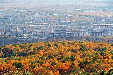
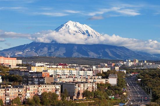
Cities of the Russian Far East: List
Major megacities include Vladivostok, Khabarovsk. These cities of the Russian Far East are of great economic and geostrategic importance for the Russian Federation. Very promising are Blagoveshchensk, Komsomolsk-on-Amur, Nakhodka, Ussuriysk. Of particular importance is the entire Yakutsk region. It should be noted that there are also endangered settlements. Most of them are in Chukotka. This is mainly due to the inaccessibility of areas and severe weather conditions.