Perm region is one of the leading regions of the Russian Federation. On its territory are the largest enterprises for the production of potash salts and chemical products. City-forming are machine-building and metallurgical plants, pulp and paper mills. All of them are actively developing and providing jobs. The cities of this region are not alike. Some of them are large industrial centers, for example Berezniki and Solikamsk, while others are in an economically depressed state.
General characteristics of the Perm region
The Perm Region is located in the European part of Russia and is part of the Volga Federal District. Its area is approximately 160 thousand square meters. m. After a referendum in 2003, the Perm region and the Komi-Permyak Autonomous Okrug merged into the Perm Territory. About 3 million people of various nationalities and religions live here. The territory of the Perm Territory is divided into 35 districts. In addition to the administrative center of Perm, another 25 cities and 45 urban-type settlements are located in this region. All of them have important industrial and agricultural significance. The largest cities are Berezniki, Krasnokamsk, Solikamsk, Chusovoy, Lysva. The postal code for Perm Region and Perm City is 614000.
Permian
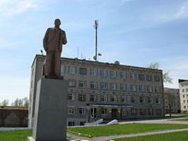
The administrative center of the Perm region is Perm. This is a millionaire city. Its population has already reached 1,026,477 people. The Perm region has become home to representatives of many nationalities, but the vast majority of those living are Russians. The city of Perm is located on the Kama River. This is a large and diversified scientific, logistic, industrial and cultural center of the Urals. The city itself was founded in 1723. In the years of the Soviet Union, in the post-war period, it was renamed Molotov.
Perm has always been an important and large transport hub. In 1876, the first railway in the Urals and throughout Siberia passed through this city. This undoubtedly affected the development of the entire region as a whole. By the way, the first university in the Urals was also opened in Perm. A map of the Perm Region contains information on more than 130 archaeological sites. This territory has been inhabited by people since ancient times. In the XVII century, these lands belonged to the famous merchants Stroganov. The very first documented information about settlements in these territories is found in the census books of Prokopiy Elizarov and they date back to 1647. Perm is currently one of the largest economic and industrial centers of Russia. It is one of the ten cities with the best entrepreneurial climate. Every year, the quality of life improves, new housing is built, jobs are created.
Berezniki

The Perm region is rich in deposits of potassium salts. They are actively mined at enterprises in the city of Berezniki. Its area is 431 square meters. km This is the second largest industrial center of the region. Berezniki have the status of an urban district. About 151 thousand people live here, but, unfortunately, due to unfavorable housing conditions, as well as the appearance of failures almost near city houses, the population is falling. The city is located on the banks of the Kama. It is located from Perm at a distance of 180 km along the highway, by water the path is 208 km. In the 80s of the last century, the ancient small town of Usolye was annexed to Berezniki. There are historical places and cultural monuments. Berezniki are distinguished by a large concentration of industrial potential. Here, heavy industry received particular development. The economy of the urban district contains a little more than 13% of the main industrial and production assets of the entire region. The share of the chemical complex is 87%. But the production of consumer goods is practically not involved here, and engineering is also not developed. The main problem of the city is dilapidated housing. Due to the formation of failures, many houses have become uninhabitable. But in general, Berezniki has great development potential.
Krasnokamsk
The city of Krasnokamsk is the administrative center of the municipal district. He received the status of urban settlement. The population for 2014 is 53 697 people. The city is located on the banks of the Kama. The distance to Perm is approximately 35 km along the highway. The city with the regional center is connected by a railway and waterways. Perm Region is a center for the production of pulp and paper products. It is in Krasnokamsk that the Goznak factory is located. This company is the leading in Russia, it specializes in the production of valuable, printed, drafting and documentary types of paper. The city-forming enterprise is a pulp and paper mill. He produces school notebooks, albums, printing and writing paper. Krasnokamsk produces the widest range of paper designed for offset printing. It meets all the standards of both Russia and Europe. In addition, the city launched the production of metal nets made of synthetic fibers.
Perm Region, Solikamsk
The city of Solikamsk is the administrative center of the district. By size it is the third city in the Perm Territory. It is located near the left tributaries of the Kama River, the Borova and Usolki rivers. The distance to Perm is 202 km by road and 370 km by rail. Here is the port of the Kama reservoir. Solikamsk is located just 30 km from the city of Berezniki. It covers an area of 166 square meters. km
Solikamsk is of great industrial importance for the entire region. It is actively mining potash salts. This is the second economic center in the Bereznikovo-Solikamsk industrial region. This territory is a single whole. Berezniki and Solikamsk closely interact with each other. According to some plans for the development of these cities, their unification is planned in the coming decades. Solikamsk is also known for the criminal elements of our population, here is the notorious White Swan Prison for
life-sentenced prisoners.Gubakha
Gubakha is the administrative center of the urban district. It is located in the center of the Kizelovsky coal basin. The distance to Perm is 219 km along the highway. A line of the Chusovaya-Solikamsk railway passes through Gubakha. Within the city limits, the land area is 4297 ha. Of these, 1648 hectares are built up, 195 hectares are allocated to parks, squares and other green spaces. The length of city streets is 102 km. According to 2014 data, the population is 21,658. The city is known for having karst phenomena on its territory. These are, first of all, gaps and caves. Like other cities of the Perm region, Gubakha is famous for industrial production. The largest city-forming enterprise is Metafraks OJSC. It is engaged in the production of chemicals. These are formalin, methanol, pentaerythritol, urotropine, urea-formaldehyde resins, sodium formate, process oxygen, etc. The city has another large enterprise - the Gubakha Coke and Chemical Plant. It produces products such as coal varnishes, ammonium sulfate, coke, tar, benzene and much more.
Kungur
The administrative center of the Kungur region is the city of Kungur, the Perm region is rich in various monuments of cultural heritage, as well as unique natural places. One of them, ice caves, is located here. Kungur has the status of an urban district. It is a historical city of Russia. He received this title in 1970. The distance to Perm is 90 km. The population according to 2014 is about 67 thousand people. The area of the city is 69 square meters. km
Lysva
This is the administrative center of Lysvensky urban district. It is located east of Perm. The distance to the regional center is 86 km along the highway. The area of the city is 26 square meters. km According to 2014 data, the population is 64 thousand people. The city was built on the banks of the Lysva River. This area is an incised deep valley. The Chusovoy – Kuzino railway line was laid across the city. Like many cities in the Perm region, Lysva is famous for its industrial enterprises. Metalworking and mechanical engineering are developed here. Also, enterprises of the city produce building materials. Agriculture is also developed here.
Perm Region, Kizel
This is the administrative center of the Kizelovsky municipal district. The population is 21 thousand people. The city is subject to several settlements. Kizel Square - 75.82 square meters. km Total built up houses no more than 3 square meters. km Distance to Perm - 244 km on the highway. The city is a station of the Chusovaya-Solikamsk railway line. It is located in the western foothills of the Middle Urals. The city got its name thanks to the Kizel River, on which it is located. There used to be coal mining enterprises here. Now the district is in an industrial depressive state. The population is employed in the public sector.