The geographical position of Spain and the features of its rapid (emotional!) Historical development have greatly contributed to the fact that now the birthplace of flamenco and bullfighting has become a "solarium" of world significance. Today, this South European state has become a well-known destination for tourist destinations. This is not surprising - it seems that the sun never sets here.
Spain’s super-good geographical position on the map of Europe, thousands of amazing landscapes, the intersection of many ancient and original cultures, as well as European-style exquisite service created her the glory of a real tourist Eden. Most often, numerous lovers of relaxation, fresh emotions and vivid impressions visit Ibiza, Mallorca and the Mediterranean beaches, stretching hundreds of kilometers between Valencia and Barcelona. But the most interesting is hidden from the eyes of curious tourists in the depths of the Iberian Peninsula.
Spain’s almost perfect geographic location, not only in terms of tourism, but also geopolitically and economically, has made this country one of the most prosperous, developed and attractive in the world. To a large extent this was facilitated by the majestic and inaccessible Pyrenees mountains. The geographical position of Spain in a sense led to the natural isolation of this country from most European military conflicts of the twentieth century, which allowed it to develop while Europe was burning in the crucible of hostilities. True, this relative isolation did not save Spain from a destructive and brutal civil war. However, this is a completely different topic.
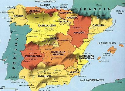
As for the geographical position of this amazing country, it occupies eighty-five percent of the Iberian Peninsula, the remaining fifteen belong to Portugal. Andorra and Gibraltar can be ignored because of their "microscopic" sizes. Spain, whose geographical position had a huge impact on the historical, cultural and economic development of this country, also owns the Balearic, Pitius Islands (they make up one province) in the Mediterranean Sea and the Canary Archipelago in the Atlantic.
Spain is the highest country in Europe after Switzerland. Mountains, plateaus and plateaus occupy about ninety percent of its territory. Spain, the length of the land borders of which is 3144 km, is washed by the waters of the Mediterranean Sea and the Atlantic. The largest plateau of the country - Meseta - occupies almost half of its territory. In the west of this gigantic mountain plain, there are many tectonic faults alternating with picturesque river valleys.
The mountain system Central Cordeliers divides Meseta into two parts - the Starokastilsky and Novokastilsky plateaus. A significant part of Meseta is characterized by an extremely low average annual rainfall. For example, the province of Almeria can be safely called the only real desert of Europe - nature gave it such an insignificant amount of moisture. However, there are also quite lush flowering oases. Spain almost all consists of similar contrasts. And not only natural.
The Spanish coast, which is so attractive for tourists, also has a variety of landscapes and landscapes. There are dunes, cliffs and, of course, many beaches covered with sand and pebbles. The coast of Galicia with its coastline resembles the Norwegian fjords, and the Atlantic coast is replete with a variety of limestone capes, caves of tiny sizes and grottoes.
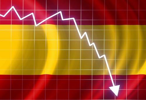
Of particular note is the economic and geographical position of Spain. In the second half of the last century, Spain became one of the fastest growing and largest economies in the world. And all this is due to progressive reforms, a well-designed investment policy and, to some extent, its geographical isolation. She managed to survive the recent economic crisis with less losses than some other members of the European Union. It is not for nothing that today Spain is called a country that has "rebooted" its economy.