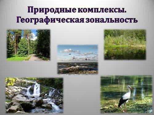
Everyone knows that on Earth, the distribution of solar heat is uneven due to the spherical shape of the planet. As a result of this, different natural systems are formed, where in each all the components are closely connected with each other, and a natural zone is formed, which is found on all continents. If you follow the fauna and flora in the same zones, but on different continents, you can see a certain similarity.
The law of geographical zoning
Scientist V.V. Dokuchaev at one time created the doctrine of natural zones, and expressed the idea that each zone is a natural complex, where living and inanimate nature are closely interconnected. Subsequently, on the basis of the teachings, the first qualification was created, which was finalized and more concretized by another scientist L.S. Berg.
The forms of zoning are different due to the diversity of the composition of the geographic envelope and the influence of two main factors: the energy of the sun and the energy of the earth. These factors are associated with natural zoning, which manifests itself in the distribution of the oceans, the diversity of the relief and its structure. As a result of this, various natural complexes were formed, and the largest of them is the geographical zone, which is close to the climatic zones described by B.P. Alisov).
The following geographical zones are distinguished: equatorial, two subequatorial, tropical and subtropical, temperate, subpolar and polar (Arctic and Antarctic). Geographical zones are divided into zones, which should be discussed more specifically.
What is latitudinal zoning?
Natural zones are closely connected with climatic zones, which means that zones like zones are gradually replacing each other, moving from the equator to the poles, where solar heat decreases and precipitation changes. Such a change in large natural complexes is called latitudinal zonality, which manifests itself in all natural zones, regardless of size.
What is high altitude zoning
The map shows, if you move from north to east, that in each geographical zone there is a geographical zoning, starting from the Arctic deserts, passing to the tundra, then to the forest-tundra, taiga, mixed and broad-leaved forests, forest-steppe and steppes, and, finally, to the desert and subtropics. They stretch from west to east in stripes, but there is another direction.
Many people know that the higher you go up into the mountains, the more the ratio of heat and moisture changes more towards low temperature and solid precipitation, as a result of which the flora and fauna change. Scientists and geographers gave this direction their name - altitudinal zonality (or zonality), when one zone replaces the other, encircling mountains at different heights. At the same time, the change of belts is faster than on the plain, you just have to climb 1 km, and there will be another zone. The lowest zone always corresponds to where the mountain is located, and the closer it is to the poles, the less these zones can be found at altitude.
The law of geographic zoning also works in the mountains. From the geographical latitude depends on seasonality, as well as the change of day and night. If the mountain is close to the pole, then you can meet polar night and day, and if the location is near the equator, then the day will always be equal to night.
Ice zone
The natural zoning adjacent to the poles of the globe is called icy. Harsh climate, where snow and ice lie all year round, and in the warmest month the temperature does not rise above 0 °. Snow covers the whole earth, even though the sun shines for several months around the clock, but does not warm it at all.
Under too harsh conditions, few animals live in the ice zone (polar bear, penguins, seals, walruses, arctic fox, reindeer), even fewer plants can be found, since the soil-forming process is at the initial stage of development, and mainly unorganized plants are found (lichen , moss, algae).
Tundra zone
A zone of cold and strong winds, where there is a long long winter and a short summer, because of which the soil does not have time to warm up, and a layer of perennial frozen soils forms.
The zoning law even works in the tundra and divides it into three subzones, moving from north to south: the Arctic tundra, where moss and lichens grow mainly, the typical lichen-moss tundra, where shrubs appear in places, is common from Vaigach to Kolyma, and the southern shrub tundra, where vegetation consists of three levels.
Separately, it is worth mentioning the forest-tundra, which extends a thin strip and is a transition zone between the tundra and forests.
Taiga zone
For Russia, Taiga is the largest natural zone that extends from the western borders to the Sea of Okhotsk and the Sea of Japan. Taiga is located in two climatic zones, as a result of which there are differences within it.
This natural zoning focuses a large number of lakes and swamps, and it is here that the great rivers in Russia originate: the Volga, Kama, Lena, Vilyui and others.
The main thing for the plant world is coniferous forests dominated by larch, spruce, fir, and pine are less common. The fauna is heterogeneous and the eastern part of the taiga is richer than the western.
Forests, forest-steppes and steppes
In the zone of mixed and broad-leaved forests, the climate is warmer and wetter, and latitudinal zonality is clearly visible here. Winter is less severe, summer is long and warm, which contributes to the growth of trees such as oak, ash, maple, linden, hazel. Due to the complex plant communities in this area, a diverse fauna and, for example, bison, muskrat, wild boar, wolf, and elk are widespread in the East European Plain.
The zone of mixed forests is richer than in conifers, and there are large herbivores and a wide variety of birds. Geographical zoning is distinguished by the density of river reservoirs, some of which do not freeze at all in winter.
The transition zone between the steppe and the forest is the forest-steppe, where there is an alternation of forest and meadow phytocenoses.
Steppe zone
This is another species that describes natural zoning. It differs sharply in climatic conditions from the above-mentioned zones, and the main difference is the lack of water, as a result of which there are no forests and cereal plants and all the various herbs that cover the ground with a continuous carpet predominate. Despite the fact that there is not enough water in this zone, the plants tolerate drought perfectly, often their leaves are small and can be folded during the heat to prevent evaporation.
The animal world is more diverse: ungulate animals, rodents, and predators are found. In Russia, the steppe is the most developed by man and the main zone of agriculture.
Steppes are found in the Northern and Southern Hemispheres, but gradually they disappear due to plowing of the land, fires, and grazing animals.
Latitudinal and high-altitude zoning is also found in the steppes; therefore, they are divided into several subspecies: mountain (for example, the Caucasus mountains), meadow (typical of Western Siberia), xerophilous, where there are a lot of turf-bearing cereals, and desert (they became the steppes of Kalmykia).
Desert and tropics
The sharp changes in climatic conditions are due to the fact that evaporation exceeds precipitation by many times (by 7 times), and the duration of this period is up to six months. The vegetation of this zone is not rich, and mainly grasses, shrubs are found, and forests can only be seen along rivers. The fauna is richer and a bit similar to that found in the steppe zone: there are many rodents and reptiles, and ungulates roam in the surrounding areas.
The Sahara is considered the largest desert, but in general this natural zonality is characteristic for 11% of the entire earth's surface, and if you add the Arctic desert to it, then 20%. Deserts are found both in the temperate zone of the Northern Hemisphere, and in the tropics and subtropics.
There is no unambiguous definition of the tropics, geographic zones are distinguished: tropical, subequatorial and equatorial, where there are forests similar in composition but having certain differences.
All forests are divided into savannas, forest subtropics and tropical forests. Their common feature is that the trees always stand green, and these zones differ in the duration of dry and rainy periods. In the savannahs, the rainy period lasts 8-9 months. Forest subtropics are characteristic of the eastern margins of the continents, where a change occurs in the dry period of winter and wet summer with monsoon rains. Rainforests are characterized by a high degree of moisture, and rainfall can exceed 2000 mm per year.