It is not so easy to find the East Siberian Sea on the map right away. The fact is that its borders are conditional and only in some places are limited to land. In the western part, the limit is Kotelny Island and the Laptev Sea; in the north - the edge of the shallows of the mainland; in the east, the border is the meridian passing through Wrangel Island; in the southern part, the sea is limited to the mainland.
Dimensions and Depth
The maximum depth of the East Siberian Sea is 915 meters, and the average value of this indicator is 54 meters. In other words, this reservoir is completely within the limits of the mainland. Its total area is 913 thousand m 2 . As for the volume, it is approximately 49 thousand cubic kilometers.
The coast
The East Siberian Sea has a coastline that is very different in its relief in the eastern and western parts. In its landscapes there are quite large bends, which in some places protrude deeply, and in others they go far to land. In addition to them, straight sections are quite common. Small estruses are usually found at river mouths. In the area of the Novosibirsk Islands, the coastline is monotonous and low. A similar situation is also characteristic of the mouth of the Kolyma River. In the southern part of Long Strait, the shores are covered with a mixture of pebbles with sand, which separate the chains of lagoons.
It should be noted that the size of the depths in coastal regions is significantly affected by the amount of precipitation carried by rivers. Under their influence, bars are also formed - alluvial shallows. Among other things, river runoff raises the temperature of the water, resulting in thermal abrasion in the estuarine areas. Its speed is from one to fifteen meters per year.
Bottom structure
The sea bed is formed by the shelf, the relief of which is for the most part a plain. It is slightly tilted in a northeast direction. In the western side is the so-called "area of shallow depths." She also formed the Novosibirsk sandbank. As for the deeper places, they are characteristic of the northeastern region. A significant portion of the bottom here is covered with a sedimentary cover of small thickness. Many archipelagos and islands of the East Siberian Sea (of which there are not so many here) are formed precisely due to this foundation. These include Ayon, Bear, and Novosibirsk Islands. As various aeromagnetic images show, the composition of the bottom sediments of the shelf mainly includes sand silt, pebbles and crushed boulders. There is every reason to believe that some of them are fragments of some islands that were spread by ice throughout the territory.
Climate
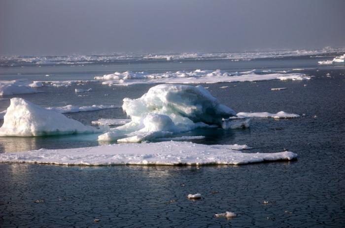
Many are interested in the question: "East Siberian Sea - what ocean is the water area?" Despite the fact that the body of water belongs to the basin of the Arctic Ocean, it is also exposed to atmospheric influences from the Pacific and Atlantic. The climate here is arctic. With it, in winter, the temperature is on average -30 degrees, and in summer - about +2. Most of the year the sea surface is covered with ice. In the eastern region, often floating ice is located off the coast, even in the summer months.
The East Siberian Sea in winter is influenced by south and south-west winds, whose speed is about seven meters per second. They bring cold air from the continent. In summer, pressure rises here, in connection with which northern rumbas begin to prevail among the winds. They are rather weak at the beginning of the season, however closer to its middle their power only increases, and the speed reaches 15 meters per second. At this time, there is mostly cloudy weather with wet snow or drizzling rain. Due to the fact that this reservoir is quite distant from the centers affected by the atmosphere, in the autumn there is almost never any return of heat.
Water temperature and salinity
Throughout the year, the surface temperature of the water in the sea decreases in the direction from south to north. In the winter season, in the areas of river estuaries, it is about -0.5 degrees, while in the northern borders it is about -1.8 degrees. In the summer, it all depends on the ice conditions. At this time, the temperature in the bays reaches +8 degrees, in areas free from ice it is about +3 degrees, and at the ice edge it is on average zero degrees. In spring and winter, the change in water temperature as it dives is insignificant. In summer, closer to the bottom, the water gets colder, especially in the western region.

The salinity level of the sea changes in a northeast direction. In spring and winter, it ranges from 4 ppm near the rivers Indigirka and Kolyma to 32 ppm in the central and northern regions. In summer, melting ice and a significant influx of river water lead to the fact that this indicator decreases. It should also be noted that the level of salinity of the water does not increase much closer to the seabed. As for such an indicator as water density, it is the highest in the autumn-winter period. In addition, it grows as you go deeper.
Hydrology
The East Siberian Sea is characterized by a not very high river runoff, in comparison with other representatives of the Arctic Ocean basin. The largest of the rivers that flows into it is Kolyma. Its runoff is approximately 132 cubic kilometers per year. The second by this value is the Indigirka River, which for the same period brings half as much water. At the same time, even in conditions of a relatively large size, the coastal runoff does not significantly affect the general hydrological situation. At present, the current system in this sea is not very thoroughly studied. It is safe to say that the general water circulation here is cyclonic in nature. As for precipitation, their average annual value ranges from 100 to 200 millimeters. Due to the fact that there are no deep gutters, and a significant area is shallow, Arctic surface waters occupy a lot of space.
The tides
The sea is characterized by semi-daily regular tides, which are caused by a wave moving to the continental coast from the north. They are best expressed in the northwestern and northern regions, while weakening in the south. This can be explained by the fact that in shallow water the tidal wave is quenched. For example, while in the section from the Shelag cape to the Indigirka river, level fluctuations are almost invisible, at its mouth the relief and configuration of the banks lead to an increase in tides by about 25 centimeters. The highest water level is characteristic for the June-July month, because at this time the largest river inflow. In winter, the level gradually decreases and in March reaches its minimum value.
Flora and fauna
The resources of the East Siberian Sea, namely flora and fauna, are rather poor. First of all, this is due to the harsh conditions created by nature itself, so only those that have proved to be the most resistant to low temperatures have taken root here. In regions of river estuaries, schools of white fish are quite large in size. Omul, grayling, whitefish, navaga, polar flounder, cod and others are also found here. Representatives of mammals are polar bears, seals and walruses. As for the birds, among them we can mention cormorants, sea gulls and guillemots. It is possible that the polar shark, which reaches six meters in length, also lives in local waters, but no clear evidence has yet been found.
Sea problems
The problems of the East Siberian Sea are in many respects similar to the problems of other northern seas, for example, the Barents, Kara, White and others. In this case, we are talking primarily about the environmental component. Despite the fact that the water here is relatively clean, Europeans for several years destroyed local biological resources, especially whales. Over time, this led to a significant reduction in their number and even to the extinction of some species. It should be noted one more problem that has recently acquired a global character. We are talking about the melting of glaciers, from which the local fauna suffers. Among other things, human activity related to the development of oil and gas fields also negatively affects the state of the water area.
Economic situation
In 1935, regular ship launches began on the so-called Northern Sea Route, laid across the East Siberian Sea. At the same time, one cannot but focus on the fact that the navigation season lasts only three months here - it begins in late July and ends in early November. At the same time, navigation is allowed only at this time and in the coastal strip.