Wiese land is a small land area with a cold arctic climate. This is an island in the northern part of the Kara Sea. There are no permanent settlements on its territory, with the exception of scientific research bases. Vise Island is a place on the edge of the world where a person’s foot rarely steps.
Kara Sea
This name is assigned to the marginal sea in the Arctic Ocean off the extreme northeastern European and West Siberian coast, as well as the Taimyr Peninsula. It is customary to classify it among the water bodies of the Eurasian sub-basin in the Arctic basin. The latter belongs to the Arctic Ocean. The Kara Sea is almost completely located outside the Arctic Circle, with the exception of the southernmost part in the Gulf of Ob, which is relatively south. All coasts of the reservoir are at the disposal of Russia.
History reference
The Kara Sea, where the island is located, has a long history. In 1736, Lieutenant Stepan Gavrilovich Malygin (the chief of the western detachment of the second Kamchatka expedition) was instructed to make a cartographic description of the sea coasts from the Pechora to the Ob River. Thus, he passed the territory of the Yugorsky Shar Strait, and at the mouth of the Kara River it was blocked by impenetrable ice. The lieutenant, along with the main members of the expedition, went by land to Obdorsk, leaving the ships for the winter with twelve sailors. By the next summer, in 1737, Malygin changed the direction of the bots to the Ob River. He compiled the “Mercatorial Map of the North Ocean ...”, which is considered to be the first map where the Yamal Peninsula was drawn. As a result, the sea was called Kara due to the place in which the crew wintered. In the period 1741-1742, the Lena detachment, part of the Great Northern Expedition, commanded by Khariton Laptev, described and mapped the coast near the Taimyr Peninsula. During the process, the lieutenant-leader investigated the area from the territory of Big Taimyr to Pyasina, and the discovery of the Nordenskjöld archipelago was also made. In addition, coasts were explored, which received their names in honor of Laptev. The navigator in the detachment (Semen Chelyuskin) described the territory of the eastern part of the coast near the Kara Sea, near the Vilkitsky Strait. An interesting fact is associated with it. At the extreme northern Asian point and at the same time the extreme eastern point of the Kara Sea coast, a section of Cape Chelyuskin converges .
The atmosphere with ice
In the period that begins in October and ends in May, the body of water, as a rule, should completely freeze. Compared to what the Barents Sea looks like , the Kara Sea was called by sailors - “ice bag”. The weather conditions are quite specific. In its northern part, where all pieces of glaciers in the ocean swim, absolutely everything is covered with a thick layer of ice.
How was Vise Island discovered?
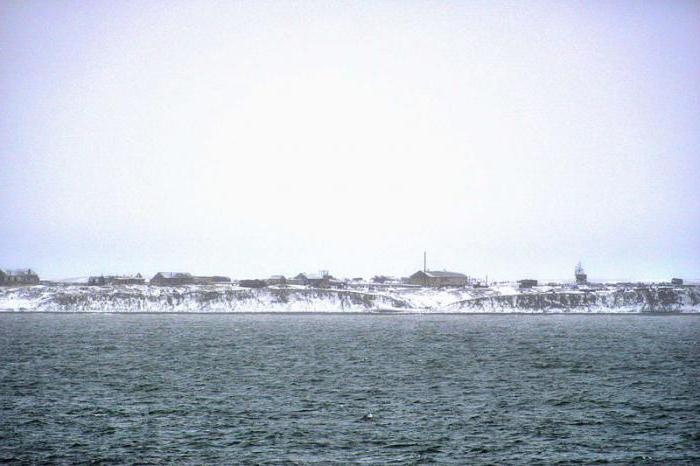
The Kara Sea, where the island is located, is quite severe. At the beginning of the 20th century, the ship with the name "St. Anna", which was headed by G. Brusilov, had to drift here. Four years later, the ship was not lucky, and it drowned, but the logbook of the watch was saved by navigator V. Albanov. In 1924, the Soviet explorer, ocean expert, meteorologist and polar scientist Vladimir Wiese studied the lines of a drifting ship, which is sandwiched among ice floes. Through deviations of the current, he was made the assumption that all this is due to the existing island. Six years later, Vladimir Vise, a member of the expeditionary team led by O. Schmidt, sailed to the future land of Vise, which he had predicted, by an icebreaking steamer named “George Sedov”. Since the fall of 1945, the southern coast has been equipped with a hydrometeorological polar station, which is one of those that are considered to be the most northern. At the moment, as before, Wiese Land does not have permanent settlers.

Geographic indicators
Vise Island is estimated at 288 square kilometers in area. The landscapes are flat with the presence of low hills. Geologically, there is a lot of clay and sea sand in the earth. Due to how global warming works, Wiese Island is gradually collapsing. It has almost no plants due to the arctic climate.
Island climate
Vise Island has a tough climate, and according to temperature indicators during the warmest weather there is a little more than zero degrees. The area is often covered in snow. Vise Island has the coldest temperature throughout the country. The absolute maximum temperature is observed in June-July (8 degrees Celsius).
Additional facts
Sergei Ivanovich Obolemov, who is the head of the meteorological station on the island, was awarded a prize from the Vysotsky memory fund for his courage and loyalty to the chosen cause. It happened about twelve years ago.