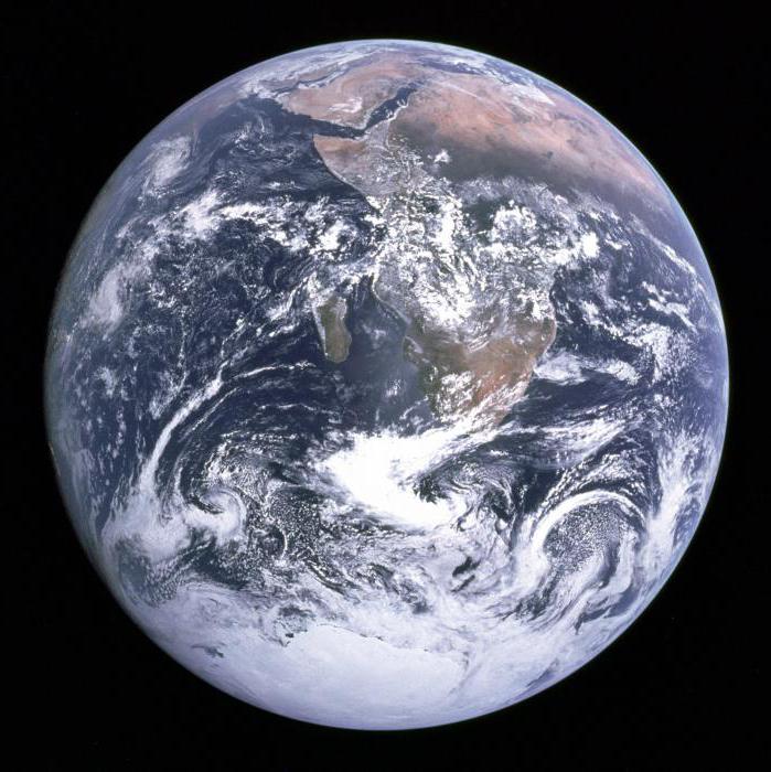
Geography as a science studies a number of features of our planet, paying much attention to the shell. The modern approach involves the separation of the planet's shell into several large zones, which are called geographical zones. At the same time, attention is drawn to a number of criteria: temperature features, the specifics of the circulation of atmospheric masses, the characteristic features of the animal, plant world.
What is there?
From geography you can find out a lot of interesting information. For example, it is known in how many time zones Russia is located: in nine. But there are six geographical zones in our country. There are nine types of geographical zones: equatorial, subequatorial (two somewhat different from each other), tropics, subtropics, temperate zones (two, each in its own half of the planet), two northern zones in each hemisphere - the Arctic and Antarctic, and also subarctic, subantarctic belts adjacent to them. Geographic are climatic zones (that is, there are two terms that apply to the same real area).
All geographical zones can be divided into natural zones. For correct division, it is necessary to analyze the temperature, humidity and identify the relationship between these parameters. Often the names of the zones were given, focusing on the type of vegetation prevailing in this area. In some cases, the natural zone is named for a term that describes its inherent landscape. So, the geographical zones of Russia include such natural zones: tundra, steppe, desert and forests. In addition, there are forest-tundra, light forests, semi-deserts and many other types of zones.
Belts and zones: is there a difference?
As is known from geography, natural zones are a latitudinal phenomenon, but the zones depend on latitude much less. The heterogeneity of the surface of our planet plays its role, due to which the level of humidity varies greatly. The same continent in different parts at the same latitude can have excellent humidity levels.
As can be seen from the geography of the globe, more often rather dry areas are located inside the mainland: steppes, deserts, semi-deserts. But everywhere there are exceptions: Namib, Atakama are classic representatives of deserts, but they are located on the coast, and in a rather cold area. The zones within the geographic zone crossing the continents are mostly heterogeneous, therefore the term “meridional sections” was introduced. As a rule, they talk about three such sites: the central one, remote from the coast, and two coastal areas adjacent to the ocean.
Eurasia: features of the mainland
The geographical zones characteristic of Eurasia are usually divided into the following additional zones: broad-leaved forest steppes go west of the Urals, coniferous and small-leaved forest steppes dominate between the Urals and Lake Baikal, and prairies are located on the territory between Sungari and Amur. Zones in some places move from one to another gradually; there are transitional areas, due to which the borders are blurred.
Features of climatic zones
Such areas are homogeneous in terms of climate; they can be interrupted or be continuous. Climatic zones are located along the latitudes of our planet. To divide the space into such areas, scientists analyze the following information:
- specifics of atmospheric mass circulation;
- level of heating from the luminary;
- change in atmospheric masses provoked by seasonal factors.
It is noted that the difference between the subequatorial climate, equatorial, moderate and other types is quite significant. Typically, the countdown starts from the equator, gradually moving up - to the two poles. In addition to the latitudinal factor, the climate is strongly influenced by the relief of the planet's surface, the proximity of large water masses, and the rise relative to sea level.
Basic theory
The well-known Soviet scientist Alisov spoke in his works about how natural geographic zones and climatic zones are distinguished, how they turn into each other and how they are divided into zones. In particular, a landmark work on climatology was published under his name in 1956. It laid the foundation for the classification of all climate zones existing on our planet. From that year to this day, not only in our country, but also practically throughout the world, the classification system proposed by Alisov has been applied. It is thanks to this outstanding Soviet figure that no one doubts anymore what climate the Caribbean islands can be attributed to, for example.
Considering the subarctic and subantarctic belt, as well as other zones, Alisov identified four main zones and three transitional zones: adjacent to the poles, adjacent to them, temperate, tropical, adjacent to the tropics and the equator. Each belt has its own unique type of climate: continental, oceanic, as well as coastal, characteristic of east and west.
Closer to warm
Perhaps the warmer places most pleasant for lovers are not the Arctic and Antarctic belts (by the way, in the old days there was an erroneous opinion that the South Pole was the warmest place on the planet), but the equator. The air here is warmed up to 24-28 degrees year-round. Water temperature during the year sometimes fluctuates by only one degree. But during the year there is a lot of precipitation at the equator: up to 3,000 mm in the flat terrain, and twice as much in the mountainous.
Another warm area of the planet is the one where the subequatorial climate reigns. The prefix “sub” in the name means “under”. This stretch is located between the equator and the tropics. In summer, the weather is mainly controlled by air masses from the equator, while in the winter, the tropics dominate. In summer, precipitation is less than that of neighbors at the equator (from 1,000 to 3,000 mm), but the temperature is slightly higher - about 30 degrees. The winter period passes almost without precipitation, the air warms up to +14 on average.
Tropics and subtropics
The tropics are divided into continental and oceanic, and each of the categories has its own characteristic feature. On the mainland, precipitation usually falls in the amount of 100-250 mm per year, in summer the air warms up to 40 degrees, and in winter - only up to 15. Over 24 hours, the temperature can fluctuate within forty degrees. But the oceanic zone is characterized by an even smaller volume of precipitation (within 50 mm), slightly lower than on the mainland, the average daily temperature in the summer is up to 27 degrees. And in winter it is just as cold here as it is offshore - about 15 degrees Celsius.
Subtropics - this is such a zone that provides a smooth transition from the tropical geographical zone to the moderate. In summer, air masses “come in with weather” coming from more southerly neighboring areas, but in winter - from temperate latitudes. In summer, the subtropics are usually dry and hot, the air warms up to 50 degrees Celsius. In winter, this climate is characterized by cold, precipitation, snow is possible. True, there is no permanent snow cover in the subtropics. Precipitation falls in an amount of approximately 500 mm per year.
Dry subtropics are usually located in the mainland, where it is very hot in the summer, but in the winter the thermometer drops to minus twenty. Precipitation falls in an amount of 120 mm per year, or even less. The Mediterranean also belongs to the subtropics, and the name of this area gave the name to the geographical zone - the Mediterranean, characteristic of the western extremities of the continents. It is dry and hot in summer and cool in winter and it rains. Usually up to 600 mm of precipitation falls annually. Finally, the eastern subtropics are monsoons. It is cold and dry in winter (in comparison with other parts of the subtropical geographical zone), in summer the air warms up to 25 degrees Celsius, it rains (about 800 mm of rainfall).
Temperate climate
Any educated resident of Russia should know how many time zones (nine) and how many climatic (four) are in the territory of their native country. At the same time, the temperate climatic and geographical zones dominate. It is characterized by temperate latitudes and has a rather large annual rainfall: from 1,000 to 3,000 in coastal areas. But in the inner zones, precipitation is often small: only 100 mm in some places. In summer, the air warms up to a temperature of 10 to 28 degrees Celsius, and in winter it varies from 4 degrees Celsius to frost, reaching -50 degrees. It is customary to talk about marine, monsoon, continental temperate sections. To know them, as well as how many time zones Russia is located in (nine), should be any educated person who has completed a school geography course.
The marine climate is characterized by a rather large amount of precipitation: in mountainous areas up to 6,000 mm fall annually. On the plain, usually less: from 500 to 1,000 mm. In winter, the air warms up to five degrees of heat, and in summer - up to 20. In the continental part, about 400 mm of precipitation falls during the year, the warm season is characterized by air heated to 26 degrees, and in winter frosts reach -24 degrees. The continental temperate zone is the area where persistent snow cover lies for several months of the year. There are many territories where this period is very long. Finally, the moderate monsoon is such an additional type of climate, which is characterized by an annual rainfall of up to 560 mm. In winter it is usually clear, frost reaches 27 degrees, and in summer it often rains, the air warms up to 23 degrees.
On North!
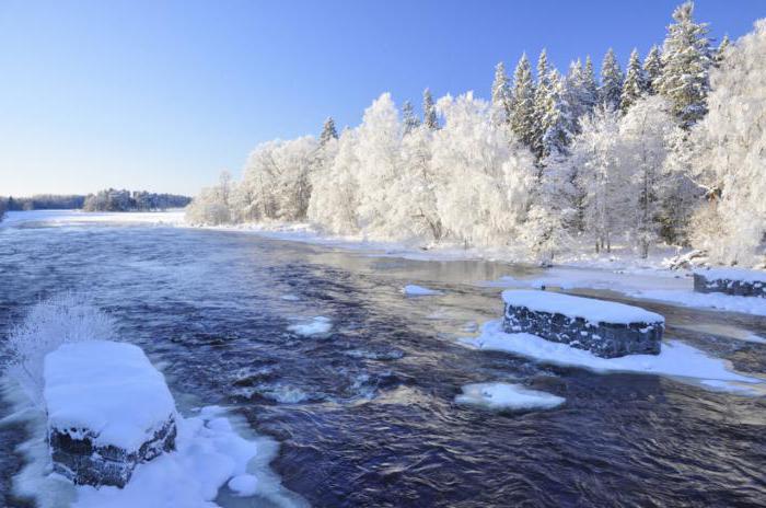
The subpolar climate is two poles adjacent, respectively, to the Arctic and Antarctic. In summer, the area is pretty cool, as humid air comes from temperate latitudes. Usually a warm period is characterized by warming of air masses up to 10 degrees of heat, precipitation - at the level of 300 mm. However, depending on the specific area, these indicators vary significantly. For example, in the northeastern parts of Yakutia often only 100 mm of precipitation falls. But winter in a subpolar climate is a cold reigning for many months. At this time of the year, air masses coming from the north dominate, and the thermometer column drops to -50 degrees, or even lower.
Finally, the coldest are the Arctic and Antarctic belts. The climate reigning here in geography is considered polar. It is typical for latitudes above 70 degrees - in the north and below 65 - in the south. This area is characterized by cold air and year-round snow-resistant cover. Precipitation is not typical of such a climate, but the air is often filled with tiny needles of ice. Due to the subsidence of these masses, snow increases over the year, comparable to 100 mm of precipitation. On average, in summer the air warms up to zero Celsius, and in winter frost reigns up to -40 degrees. Geographic coordinates of the poles of the earth:
- in the south - 90 ° 00′00 ″ south latitude;
- in the north - 90 ° 00′00 ″ north latitude.
Geographical time zones
Another important geographical division of our planet is due to the specifics of the rotation of the globe around its axis and around the sun. All this affects the change of time of day - in different places the day starts at different times. How many time zones exist on our planet? The correct answer is 24.
The fact that it is impossible to uniformly illuminate the entire surface of the planet became clear when humanity discovered that the Earth was not a flat surface at all, but a rotating ball. Therefore, as scientists soon found out, on the surface of the planet there is a cyclical change of time of day, sequential and gradual - it was called the change of time zone. At the same time, astronomical time is determined by the position of the Sun at its zenith, which is characteristic of different parts of the globe at different times.
Milestones and Geography
It is known that in former times the astronomical difference did not actually create any problems for humanity. To determine the time, it was only necessary to look at the Sun; noon was determined by the moment when the star passes the highest point above the horizon. At that time, ordinary people often didn’t even have their own hours, but there were only city watches, which distributed information about the time change to the entire village.
The concept of “time zone” did not exist, in those days it was impossible to imagine that it could be relevant. Between settlements located nearby from each other, the time difference was minutes - well, say, a quarter of an hour, not more. Given the lack of telephone service (and even more so high-speed Internet), as well as the limited capabilities of vehicles, such time shifts did not represent a really significant difference.
Time synchronization
Technological progress has confronted mankind with an abundance of new tasks and problems, and one of them has become the synchronization of time. This changed human life quite a lot, and the time difference turned out to be a source of considerable headache, especially at first, until a solution in the form of a change of time zones with the systematization of this phenomenon did not exist. The first to feel the whole complexity of changing time intervals were those who traveled by trains over long distances. One meridian was forced to shift the hour hand by 4 minutes - and so all the way. Of course, following this was not easy.

Railroad workers were in an even more difficult situation, because the dispatchers simply could not tell in advance and exactly at what point in time and in what place of space the train would be. And the problem was much more significant than a possible delay: the incorrect schedule could lead to clashes and numerous casualties. To get out of this situation, it was decided to introduce time zones.
Order restored
The initiator of the introduction of time zones was the famous English scientist William Wollaston, who worked with metal chemistry. Surprisingly, it was the chemist who solved the chronological problem. His idea was as follows: call the territory of Great Britain one time zone, give it the name Greenwich. Representatives of the railway quickly appreciated the benefits of this proposal, and the common time was introduced already in 1840. After another 12 years, the telegraph regularly transmitted a signal about the exact time, and in 1880 the whole of Great Britain switched to a single time, for which the authorities even issued a special law.
The first country to catch the English fashion at the exact time is America. True, the States on the territory are much larger than England, so the idea had to be improved. It was decided to divide the entire space into four zones, in which time with neighboring sections differed by an hour. These were the first time zones in the history of our time: Center, Mountains, East and Pacific zone. But in cities, people often refused to follow the new law. The last to resist the innovation was Detroit, but here too the public finally surrendered - since 1916 the clocks have been moved, and since then time has reigned, consistent with the division of the planet into time zones.
Idea captures the world
The first propaganda of dividing space into time zones attracted attention in different countries even at a time when time zones were not introduced anywhere, but the railway already needed a mechanism for coordinating time intervals. Then for the first time the idea was voiced of the need to divide the entire planet into 24 sections. True, politicians and scientists did not support her, they called it utopia and immediately forgot it. But in 1884 the situation changed radically: the planet was divided into 24 parts during a conference with the participation of representatives of different countries. The event was held in Washington. A number of countries spoke out against the innovation, among them was a representative of the Russian Empire. Our country recognized the division into time zones only in 1919.

Currently, the division into time zones is recognized throughout the world and is actively used in various areas of life. The need for time synchronization, also due to the fast connection with different corners of the earth using the latest technology, is now more relevant than ever. Fortunately, technical means come to the rescue of a person: programmable clocks, computers and smartphones, through which you can always find out exactly how much time is in any part of the planet and how much this time differs from a characteristic other area.