The Neman is a river originating in the south of the Minsk Upland. It flows through Lithuania, Belarus and the Kaliningrad region. Its total length is 937 kilometers, and the catchment area is 98 thousand square kilometers. In the lower part of the Neman is a natural boundary between the Russian Federation and Lithuania. The river is considered the cleanest water stream in Belarus. The reason for this is the low population density and the lack of industrial enterprises along the coast and in the basin. The Neman is the largest river in Lithuania, the 3rd largest in Belarus and the 14th in Europe. Water flows into the Curonian Lagoon of the Baltic Sea. This is the lagoon between the mainland and the scythe. On its shore is the Lithuanian city of Klaipeda.
Hydrology and hydrography of the Neman
Neman is a river with mixed water supply. But in the upper reaches it is mostly snowy, in the lower reaches it is rain. The water flow basin has a high indicator of lake content - 2.5%. Water consumption per year (average) - 678 m 3 / s. Spring flood lasts a long time - from mid-March, April and May. Floods are typical for autumn and winter. In the summer - low water. Ledostavit - at the end of November - beginning of December, but in warm winters temporary openings of the river and ice drift are possible. The source is located on the Belarusian ridge, at an altitude of 176 meters. These are 2 small rivers: Losha and Nemanets. To the borders with Lithuania from these places 459 kilometers.
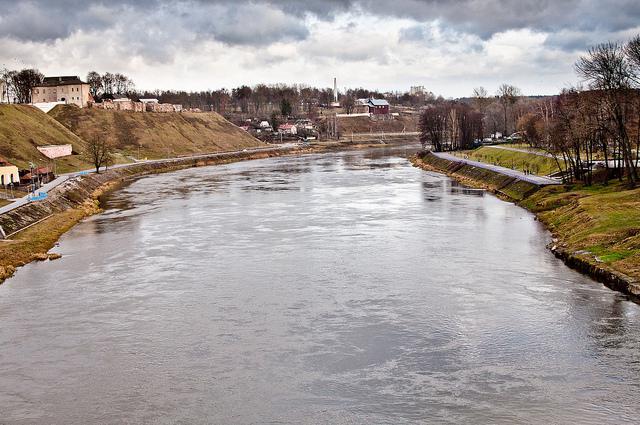
But fickle Neman. The river in its upper reaches has a flat character. And at the intersection of the moraine ridges, the valley of the water stream sharply narrows to one and a half kilometers and cuts to a depth of 40 meters. Here the bottom of the channel is rapids and stony. In the lake-glacial lowlands, the Neman valley expands to 20 kilometers. The bottom becomes sandy, islands appear in the river, and in the floodplain of the old woman. The banks of the Nemunas are always asymmetrical. The width of the river in the upper reaches is not more than 40 meters, in the middle - not more than 150 meters, in the lower reaches - up to 400 meters.
Neman story
Scientists believe that the river in these places existed more than 1 million years ago. The constant convergence of the Scandinavian glaciers did not interfere with the life of the water stream, as soon as they receded, it reappeared. On the banks of the Neman, people first appeared about 12 thousand years ago. In the X century, the Slavs settled in the upper reaches, and the ancestors of the Lithuanians in the lower reaches. The name of the river has Baltic roots and translates as “home”, “ours”, “ours”. The Neman was first mentioned in the Ipatiev Chronicle in connection with the construction of a monastery on the river in the 13th century. But the water flow was included by Ptolemy in the “Map of European Sarmatia” back in the 2nd century AD.
Interesting events and facts related to the Neman
An artistic description of the Neman River can be found in the works of such writers and poets as Adam Mickiewicz, Janka Lucina, Vladislav Syrokomlya and Yakub Kolas. She is devoted to many songs, including the most famous folk work “Neman - the Wondrous River”. During the Great Patriotic War, the river became a symbol of the military fraternity of Russian and French pilots, which was expressed in the name of the famous squadron "Normandy - Neman." The Polish pianist Cheslav Nemen took a stage name for himself in honor of the water stream on the banks of which he grew up.
He took part in the filming of the film "Three in a boat, not counting the dog" Neman. The river turned into the English Thames. At the Russian fortress of Kovno, standing on the border, Napoleon’s army attacked the Russian state in 1812 over 4 crossing bridges. To such large cities as Kaunas, Sovetsk and Grodno, the Neman River gave life.
Shipping
Neman is a navigable river. Regular communication is established between the Belarusian city of Grodno and Lithuanian Druskininkai. The lower reaches of the river are cut off by the Kaunas Hydroelectric Power Station (1959), which is not equipped with a lock. During the “high water”, ships with building materials, timber and other cargo can rise above the confluence of the Berezina tributary with the Neman. Shipping is possible from April to October. Also from the Neman you can go to the Vistula and the Dnieper through canals. In summer, pleasure boats go along the river and river cruises are made.
The tributaries and canals of the Neman
The Oginsky Canal, built at the end of the 18th century, unites the river with the Dnieper. This waterway was built so that small ships could get from the Baltic Sea to the Black Sea . The Neman and the Vistula are connected by the Augustow Canal, built in the first half of the 19th century. It is an architectural monument and is protected by UNESCO. The tributaries of the Neman River are numerous - about 180. The largest of them are Merkis with a length of 206 km; Vilia (its length is 510 km); Shchara (325 km); Shusupe (298 km); Zelvyanka (170 km); Gavia (100 km). Almost all rivulets flow from swamps. In the XX century, in the lower reaches of the swamps began to be drained for peat extraction. The channels of the tributaries began to deepen and level, which significantly violated the hydrological regime of both the tributaries and the Neman itself.
Nature of the Neman River
On the banks of the Neman, a mixed forest mainly grows, in which coniferous trees are predominant. The main arrays are located on the Berezina River. This is Grodno Forest, Nalibok Forest. Neman is very attractive to fishermen. Here bream, pike, crucian carp, perch, bleak, pike perch and roach are found. Fishermen on a bite on the Neman never complain. After spawning ends in early June, lovers of active tourism go down to the water, mainly kayakers. There are ready-made routes from local travel agencies, but you can go on your own. The length of the path from Lida (this is where routes usually begin) can be up to 150 kilometers. The Neman is attractive for all types of tourism: water, cycling, horseback riding or hiking. The banks of the river are rich in natural, architectural, historical and archaeological sites.