Each of our compatriots knows about the Amur region. However, not everyone can quickly find it on the map. And only a relatively small number of people know at least something about the area of the Amur Region, its population, nature and history. We will try to fill this knowledge gap.
A bit of geography
To begin with, it is worth saying that the area of the Amur Region in square. km is quite large - almost 362 thousand. That is approximately like Germany or almost four Portugal. The region is located in the southeast of the country, right on the border with China.
It is very elongated from north to south, so the climate varies significantly. In the northwest, sharply continental prevails: summers are hot and dry, and winters are rather cold, with a lot of rainfall. But in the southeast, a completely different picture is observed: a great influence of air masses from the Pacific Ocean is created by the monsoon climate, characterized by a large amount of precipitation in the summer and a small amount of precipitation in the winter.
In winter, the average minimum temperature ranges from -22 to -31 degrees: such a difference is not surprising, if we recall the total area of the Amur region. The registered absolute minimum was -45 degrees Celsius. But the summer is hot: in the north, the temperature sometimes reaches +38 degrees, and in the south - +40 degrees. True, in the highlands the average summer temperature is only +12 degrees.
The whole territory is divided into 20 districts. Moreover, the area of the Amur region is very different: from 2510 square kilometers (Tambovsky) to 87,500 (Zeysky).
Briefly about nature
Strong changes in temperature and humidity provided these places with an amazing variety of flora and fauna. Mountains and swamps, rivers and lakes, forests and plains, the harsh north and the hot south - all this allowed this territory to become a home for a variety of plants and animals.
Almost 70% of the territories are covered with dense forests. Alas, this number is gradually decreasing due to uncontrolled felling, primarily by Chinese citizens. In the east, spruce and fir are most common. In taiga northern lands there are many larch. In the southeast, you can often see centuries-old cedars and beautiful oaks, remembering the times when the first Russian settlers only built their houses here. But still, the main long-liver of these places is not oak at all, but Amur velvet. Walking through the forest because of the vines can be very difficult: a wild vineyard, actinidia and lemongrass tightly intertwine the branches of trees and shrubs. A large number of fruit and berry plants are growing here: bird cherry, honeysuckle, mountain ash, raspberries, hawthorn and many others.
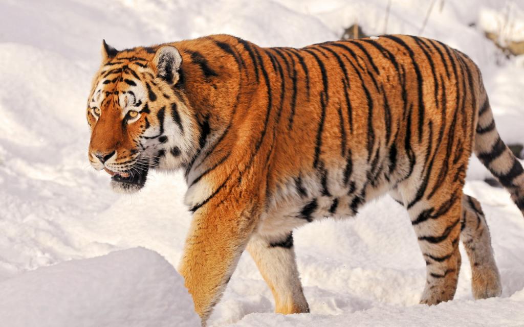
The fauna of these places is no less rich: the area of the Amur Region is densely populated by a variety of animals. There are also ordinary squirrels, foxes, bears, moose and Manchurian deer. In the thick of forests you can often see sable, lynx, Amur forest cat, musk deer and even the largest feline on the planet - the Amur tiger. Muskrats, minks, as well as Far Eastern turtles live on the banks of water bodies.
History tour
Monuments about the first people who lived in these parts date back to the 11th millennium BC. Various tribes lived here, from the Paleolithic to the Neolithic.
Russian people came here in the middle of the seventeenth century, or rather, in 1644. It was then that Vasily Poyarkov arrived here with a detachment . Despite numerous skirmishes with the local people, the Daurs, who were supported by the Manchus, they managed to gain a foothold and create the Albazin Voivodeship. Over time, the Aigun Treaty was concluded and these lands were officially assigned to Russia.
During the Civil War, these lands became part of the Far Eastern Republic. But in 1922 it became part of the RSFSR, and specifically in the Far Eastern Territory. In 1938, the administrative unit was divided into Primorsky and Khabarovsk Territories, these territories became part of the latter. Finally, in 1948, the Amur Region was singled out as a separate administrative unit, which it remains to this day.
Population
It's hard to believe, but in the middle of the nineteenth century the total population of these lands (according to the census) was only 2950 people! Imagine the area of Germany where such a handful of people live!
But every year the population increased and by the end of the XIX century, almost 100 thousand people lived here. On the eve of World War II, almost 700 thousand inhabitants lived here. Alas, the terrible war greatly reduced the population: people from here became a real nightmare for the German invaders, but they themselves died in large numbers on the most dangerous sections of the front line. The post-war population was only 450 thousand people.
But in subsequent years, until the collapse of the USSR, the population grew and exceeded one million by the end of the 80s. Since then, every year the number of people has only declined; positive dynamics has not been recorded even once. Today, less than 800 thousand people live here.
Of these, 94% are Russian people. The second place remains for Ukrainians - about 2%. In third place, Belarusians - 0.5%. Armenians are only slightly inferior to them - 0.48%. Also here you can see Azerbaijanis, Tatars, Uzbeks, Germans and representatives of many other nationalities. From local tribes Evenks, Buryats, Yakuts and others live here.
Conclusion
Now you know more about the Amur Region, its territory, climate and population. Surely this will significantly expand your horizons.