Mensula is a geodetic instrument in the form of a device, standing on a tripod of three or four legs. Mensula is translated from Latin "table". This is a device or tablet made from a board that stands on a tripod. The table is covered with a white Whatman paper and is attached to a tripod using a menzulny box. The device tablet is equipped with a sighting device in the form of a kipregel or alidade, a plumb and a compass. The upper casing of the mensula rotates on the lower base with fixing and guiding screws. Kipregel points of view of the area, whether it is a mountain, river, intersection or lake and others.
The concept of mensula
Mensula is equipped with a level in order to be sure of its horizontal location relative to the terrain. In addition to the telescope, the kipregel consists of a copper ruler, with which you can calculate the scale, length, height of the measured and fixed object. We will talk about its structure separately.
This invention appeared in Bavaria at the beginning of the 17th century to compile a topographic plan of the area. Today, menzulu is used to produce maps in relatively small areas with an approximate scale of 1: 5000 to 1: 500. Recently, mensules with semi-automatic mechanisms of kipregels have appeared. They allow you to shoot a terrain scale of 1: 10000, which greatly automates the process.
General concepts
Surveying instruments measure angles, direction and distance. After shooting, people are engaged in calculating coordinates in their office, write down and draw the results on a ready topographic plan. How to carry out a manual shooting? Its technological process differs from the others in that all the calculations, construction and plotting are work on fixing the terrain. It is made directly in the field in manual mode.
Mensul shooting is a technological type of geodetic survey of the area, which, with minimal effort and time, makes it possible to get a plan of the territory right on the spot, where the relief and other features are displayed in the form of conventional signs. This is a set of works for drawing up a graphic plan. With the help of various devices, points are denoted that indicate any objects, in accordance with the calculated scale.
The structure of the mensula
The menzule is mounted in the right place on a stable tripod. The box is equipped with different screws. It is called menzulnaya, and it contains:
- lead screws;
- lifting;
- screws securing the mensula and the tablet.
Made usually from linden, the mensul board is strong, light and does not crack for a very long time. It has an ideally even surface with a thickness of 3 cm and a length and width of 60 cm. Sheets of aluminum or plywood are installed on top of this board. On them, having previously been wetted in water, a good quality drawing paper is pasted, which, after it dries, takes a perfectly even shape. When gluing paper, it is necessary to smooth it from the center to the edge so that there is no glue or starch, as well as air bubbles. Usually, a large umbrella is worn in the field for the board, so that the paper does not fade, does not fall in the rain and does not blind your eyes in the strong sun.
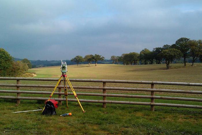
Installation of a gauge for carrying out geodetic works
In order to center the mensula, see if the network point you are depicting is on the same line with the point or object you have selected. You can orient the device by turning or rotating the base of the mensula until it matches the objects you need on the ground. You can check if your geodetic part is oriented correctly by attaching a ruler and measuring the distance from one point to another, while observing whether the milestones in the telescope coincide with the points on the paper.
In places where people do not live, it is allowed to orient the menzule in magnetic azimuth. For this, some experts use the landmark compass. It is used to orientate relative to the sides of the horizon. The level on the kipregel ruler should show a bubble at zero. This will mean that your appliance is in the correct, horizontal position.
Preparatory work
In addition to properly installing the menzula on the ground, it is necessary to carry out some preparatory work. Before carrying out geodetic work, it is necessary to apply the base points, the grid, the corners of the frame on the tablet, apply drawing paper, a shirt on top, and then cut through the windows at the locations of the mensula. The pencil with which symbols and angles are applied must be hard and always sharp, if necessary, easily and quickly erased with an eraser. Punctures made with a meter should also be very thin, barely noticeable. All excess pencil lines should be erased without delay and stains of dirt.
Centering over the required point can be done with a gauze fork. Especially if the scale is larger than 1: 2000. If the parameter is less, then it can be carried out by eye. New semi-automatic kipregels allow you to put points on the plan without moving it around the area. Their columns are equipped with a vertical circle, a cylindrical level that allows you to install the device horizontally, and a pipe with a 30x magnifier.
Operating procedure and devices used
For the correct construction of a terrain plan, it is necessary not only to carry out preparatory work, but also to observe a number of conditions when compiling a map.
Instruments used during menus shooting and execution procedure:
- Set the menzule above the previously defined point.
- Centralize and orient using a menzulny fork and level.
- Level by looking at the level on the ruler and using the lifting screws.
- Orient along the magnetic meridian or lines on the plan.
- Designate the initial curve using the cyprel head pipe.
- Calculate the distance from the start curve to the new point.
- Get the height of the point using the appropriate formula.
- Adding the height of the new point to the main one, you will get a new mark that can be fixed on the tablet.
- Mark the direction of the dot in the margins of your tablet with a thin line.

If you measure the angles between the drawn lines, then you can get the approximate height of a particular displayed object. But that is not all. Using the measured height, the terrain can also be displayed on the map. If the plot of the measured area is large, more than 15 square meters. km, you need to build a reference geodetic network and supplement it with points of the survey, analytical grid and chains. For a scale of up to 1: 5000 it is allowed to shoot on 1 filming network.
Crane Network
The points from which the vertical survey and topographic survey are conducted, the features of which depend on the topography and type of terrain, are called reference points for geodetic surveying or networks. The coordinates of these points are either already known, or they are obtained analytically using calculations. They are created using different methods, but their outcome and result are the same. Although the calculation conditions may be different. Various methods are used to accurately determine all measurements. Suppose, with an area of 2500 hectares, it is necessary that the plan had about 120-130 reference points, if the scale is 1: 10000.
Principle of implementation
Due to the correct graphical constructions, you can perform phototriangulation, depending on the shooting conditions. To do this, there are various methods in which the principles of performing a shooting survey are implemented:
- Direct serif (from two known points).
- Lateral notch (from one known and another inaccessible point, using calculations).
- Reverse resection task Potenota.
- Reverse notch according to the method of Bolotov.
Sensory shooting: the essence of the method
Having correctly placed the points of the objects, you can make a topographic plan without moving from one place to another. This survey is created in a polar way depending on the orientation of the tablet.
For mensulnogo topographic survey choose points that are fixed on the ground. Moreover, they have both coordinates and heights. There are several types of topographic survey moves. The menzulny moves are built in the directions, measured with a ruler and a thread range finder.
The menzule must be stable, the surface clean and flat, located correctly, moving easily. The kipregel must be in good condition, work smoothly, its line should be smooth. The telescope is perpendicular to the axis of rotation and the vertical filament. It is possible to justify graphically and analytically the planned menul shooting.
The paper must be drawn with a grid before conducting a menusal survey. The device is installed above the main point, say "A". It must match the one on the tablet and the one on the ground. The plumb line will help to center, the ruler is designed for orientation. The distance is determined by the range finder and compass meter on the desired scale. Total stations and vertical line angles are used to calculate elevation, or vice versa. When designating a point, the calculated object is written next to the point tilt.
At the end of the work, when all points of the terrain are transferred to the tablet, all elevations are calculated, coordinates and all angles are taken into account, they begin to draw a plan of the terrain. In this case, the relief is applied with the symbols. After direct verification, the plan is carried out to be finalized in office conditions, inked and entering the remaining designations.
Advantages of the technique
There are a number of advantages of the menzulny shooting of the area:
- Inexpensive way to remove the terrain plan.
- It is carried out on site, therefore it is highly accurate.
- Not very bulky equipment that can be transported from one point to another.
- A certain aesthetic component from close contact with the area.
- Minimum labor resources. One person can do everything.
Technology disadvantages
There are also disadvantages, due to which this type of shooting has become not very popular. Today it is being replaced by more automated methods for compiling geodetic plans for the area. The disadvantages include:
- Weather dependent.
- The long shooting process, as well as the calculation of data and bringing the plan to a reasonable conclusion, which are carried out almost verbally.
- Heavy, laborious activity.
- This process is not automated, and therefore, before you see the result in electronic form, you need to work hard. And only then can it be scanned or photographed.