Byrranga is the northernmost mountain range system in the Russian Federation. They are part of the Great Arctic and Taimyr Nature Reserve. The geological age of this system is the same as that of the Urals. The Byrranga Mountains, the highest point of which is 1125 meters above sea level, have a length of 1100 km. Their width is 200 kilometers.
The highest point and altitude fluctuations in the mountain system
Until recently, it was believed: 1146 meters - the Byrranga Mountains have such the highest height. The highest point, the name of which is Glacial Mountain, is located in the Northeast Ridge. But the results of subsequent studies showed that it reaches only 1,119 meters. Therefore, we chose another peak with a height of 1125 m, located to the east.
The entire mountain system can be divided into three regions. The western part has the lowest height - up to 320 meters. Its borders coincide with the valley of the Pyasina River and the
Yenisei Gulf. If you move east through the Byranga Mountains, their height increases and in the central part is 400-600 meters. This area of the mountain system is located between the rivers Pyasina and Taimyr. And the eastern part has heights from 600 to 1125 m. Further to the north, the mountains decrease and a gradual transition to the coastal plains is observed.
Geographical position
Byrranga Mountains is a system located on the Taimyr Peninsula, which is washed by the waters of the Arctic Ocean. They belong to the continent of Eurasia. Locals called this massif "a large rocky mountain." Byrranga - the coordinates of the mountains 73 ° 50'15 "north latitude and 91 ° 21'40" east longitude - are located beyond the Arctic Circle. This situation in the Far North creates severe weather conditions. Since these hills are difficult to reach, and they have not been studied for a long time, there may be confusion in their position on the map.
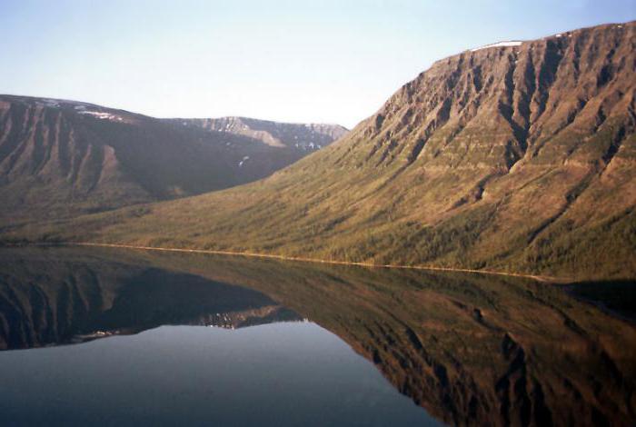
Someone believes that the Byrranga mountains are located in the Far Eastern region. In fact, they stretch in the north of Eastern Siberia and enter the territory of the Krasnoyarsk Territory. In addition, some confuse this system of ridges with the Khibiny. Based on this, they think that the Byrranga mountains are located to the north or south of the city of Murmansk. This system is located along the parallel from the Yenisei Gulf of the Kara Sea and to the Laptev Sea. It occupies a significant part of the Taimyr Peninsula. The highest point is in the east of the system - an unnamed mountain. Byrranga - the geographical position of the system creates the inaccessibility of the region - in the south it borders on the North Siberian lowland.
Relief
The mountains themselves are dissected by river valleys of great depth and represent a system, which includes about 30 ranges. The hollows are filled with alluvial deposits, there are elements of ancient sea terraces. The Byrranga mountains, the height of which allows them to be attributed to the middle elevations, are, moreover, of a folded-block type.
The peaks can have the most diverse form, both spiky and plateau-shaped. Car and circuses are common. There is permafrost and associated relief forms — kurums, heaving mounds. The relief was formed under the influence of the Quaternary glaciers. This is evidenced by the glacial landforms - troughs and moraines. In the eastern part there are also modern glaciers, in total there are 96.
Indigenous people
Before the arrival of the research expeditions, the first Byrranga mountains were discovered by the Nganasans during wanderings to the coast of the Arctic Ocean. However, these tribes did not go further than the low sections, fearing evil spirits, in their opinion, living here.
Dolgans called this place the Land of the Dead: it was believed that the souls of the dead after death were sent here. Therefore, they say that Byrranga is the abode of shamans and spirits. Of course, stone talus and ice-covered mountainsides could indeed give the impression of a "dead land" on local residents. Therefore, they tried not to enter, even wanting to reach the coast of the sea. This can be understood by the fact that on the map in the northern part most of the names in Russian are: Leningradskaya, Rybnaya. And the southern ones are in the language of the local population: Botankaga, Malakhai-Tari, Arylakh.
Nganasans lived mainly in the area of Lake Taimyr and river valleys, without climbing mountains. Their main occupation was reindeer herding. From the description of these mountains by the locals, one can understand that Byrranga is a mountain divided by river channels. And indeed, they are a system of ridges cut by numerous water streams.
According to one version, the word "Byrranga" consists of two parts. From the Yakut word "Byran" - in Russian means "hill", and the Evenki suffix "nga" meaning the plural. According to another version from the indigenous population, the name translates as "a large rocky mountain."
Explorations of the Great Northern Expedition and others
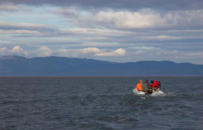
In 1736, the mountains were discovered by the Great Northern Expedition led by Pronchishchev while passing by sea along the eastern shore. After that, more than once, researchers passed through the system along the Lower Taimyr River. But the Byrranga mountains themselves were hardly explored until 1950, with the exception of the valleys. Locals were afraid to go there because they considered this place a "lower world." Middendorf, who drew this territory on the map, wrote that the Nenets farthest to the north, but none of them reached the coast.
In 1950, the very first glacier that was suddenly discovered here was called Unexpected. It is located in the area of Mount Lednikova. So in those days when it was opened, this event became a sensation in the world of geography. After all, it was believed that all the glaciers on the planet have long been discovered. After some time, several more were found. During expeditions in 1960, observation of glaciers began. It was noted later that they are decreasing in size, which indicates global climate change.
Climatic conditions
The climatic conditions of these mountains are harsh, sharply continental. In winter, average temperatures here fluctuate around -30.
The spring period begins in June and lasts two and a half months, there is practically no summer. In August, there are negative temperatures.
Precipitation is 120-400 mm per year, 270 days a year there is snow. But it’s not the cold that makes this region severe and unfavorable for life, but a very strong wind. Another feature of the climate in these places is a sharp change in weather conditions.
Vegetation and animals
The appearance of these mountains seems gloomy and lifeless, but even here you can see the greenery in the valleys in the warm season. In spring, there are areas of lush vegetation. Among flowering plants, novosversion, cereals and poppies are found. The flora of these places is characteristic of the tundra, mosses and lichens predominate.
The Byrranga Mountains, whose height also affects weather conditions, have zoning. So, with the rise up, the temperature, weather conditions, and with it the flora and fauna change.
Since the mountains are very dissected, a special microclimate is created in canyons and gorges, so the flora is very diverse for such cold places: from mountain deserts to tall grass and willow tall trees.
Among small animals, two species of lemmings live here - Siberian and ungulate. Larger animals are also found here, such as the hare and the arctic fox, and less often the ermine can be seen. The largest predator is the wolf. Deer migrate here once a year, and the musk ox was introduced in 1974 and successfully mastered this territory. A wide variety of birds.
Geology, Tectonics and Minerals
The Byrranga Mountains belong to the Hercynian folding, their formation went simultaneously with the Urals and Novaya Zemlya. The highest tectonic activity was experienced by the northeastern part.
The rocks that form the territory in the south are siltstones; there are outcrops of gabbro and diabases, dolerites formed during the Triassic and Permian periods. There are also limestones - ancient marine sediments. The northern part has Proterozoic rocks in which there are granites.
Ladders are widespread - rocks of igneous origin that form the Byrranga Mountains. Minerals are present to a large extent. Numerous promising gold deposits have been found, both ore and placer. There are also large deposits of coal and brown coal. Deposits are insufficiently studied and due to the inaccessibility of the area are not developed.
Burning coals
A phenomenon such as burning coals makes the Byrranga Mountains amazing. A photo of this process resembles a volcanic eruption. The temperature of the earth is elevated, some areas literally breathe fire and smoke. Gases go outside, and deposits of sulfur, vitriol, and quartz crystals form around. As a result of such combustion, the soil sags, and sandstones and clays become bright red and purple under the influence of temperatures. The reason for the spontaneous combustion of coal is the presence of pyrite and pyrite in the seams. During oxidation, they heat up to a certain temperature. In addition, combustion is supported by the flow of natural gas coming to the surface.
The mountain system of Byrranga has an amazing history, a kind of unique nature. In addition, there is a large reserve of minerals and other resources, which makes this area very promising. Tourism development is also possible in this region, but the inaccessibility of these places is still a significant obstacle.