The Ghor Depression, or Jordanian Rift Valley, has attracted great scientific interest from numerous scientists since the 19th century and even earlier. Mysterious geology, a variety of unique environments with their specific, partially endemic fauna and flora, as well as ancient prehistoric and archaeological sites - all this contributes to global interest, even today. Scientific expeditions from the UK and other European countries have visited and studied this region since the end of the 18th century, research usually ended with the publication of impressive volumes.
Geological origin
The place where the Ghor Depression is located is just a gift to geologists. They can study most of the rocks without much hassle, thanks to their relatively easy access to outcrops along the rift. The earliest expeditions were organized to the South Levant in the 19th century, although preliminary studies in this area were made by Lynch (1849), Lartet (1869), Hull (1886) and many others.
Parts of the rocks, starting from Precambrian and beyond, are exposed along the flanks of the Jordan Rift Valley. They demonstrate the main stages in the geological history of the Middle East, both before riftogenesis and during complex processes of rift formation. Precambrian foundation rocks are mostly exposed on the eastern slopes of the fault, along the southern end of the Dead Sea and almost continuously to the Red Sea. Rocks - both magmatic and metamorphic - make up the northernmost tip of the Arabo-Nubian massif, surrounded by large molasses that accompanied mountain building.
Geographical features of the rift valley
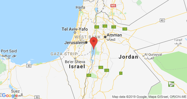
On the map, the Ghor Depression is a narrow elongated depression that separates Israel and Palestine in the west, the Kingdom of Jordan and Syria in the east for almost 400 kilometers. It also has the lowest point on Earth, the Dead Sea. It is located at an altitude of more than 400 meters below sea level and serves as the basic drainage level for the entire Jordan Valley. The depression is limited by faults on both sides, but not continuously along the entire length. Often there are internal faults, forming a complex and intricate system of rift valleys.
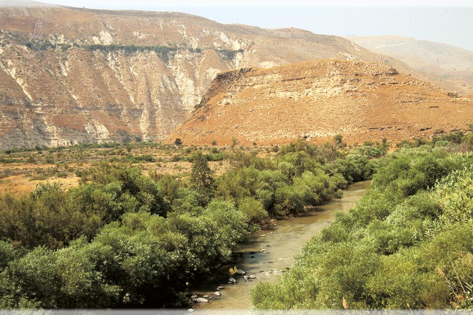
Mediterranean environment in the northern valley of the Jordan River, passing to a bare, extremely arid desert in the south. Morphology leads to relatively high temperatures, and boundary faults are responsible for many sources. The combination of heat and water created unique subtropical microenvironments along the hollow, which serve as a refuge for animals and plants of various origins. It was in the Ghor Depression that the earliest sites of hominids outside Africa were discovered. The combination of favorable conditions, ease of movement along the valley - all this made the valley the most suitable option for the settlement of early hominids. This process began at least two million years ago, maybe even earlier.
In the search for minerals
Picard, in his essay The History of Mineral Research in Israel (1954), points to the fact that in prehistoric times people had all the necessary raw materials in the Jordan Valley, as they were almost completely limited by flint and clay. However, the situation changed when metals began to be valued, among them copper was discovered and used. Iron was mined in Wadi Zarq (Nahal Yabbok), a tributary of the Jordan River, where ancient mines were found. Ores are of metasomatic origin and consist mainly of limonite and hematite. It was supposed that gold was imported, but recently a small early Islamic mine was discovered near Eilat.
Following the termination of the British mandate, several promising areas of production were listed. Dead Sea for potassium, bromine and magnesium; Mount Sedom for oil, bitumen and salt; Nabi Musa and the Yarmouk area for bituminous limestone; Nabi Musa for phosphates and Menachemia for gypsum. Hulu Lake with peat and natural gas should be added to them.
Hydrology of the valley
Today, the valley is an internal drainage basin with an area of about 40,000 km 2 , the end point of which is the Dead Sea. The main waterway is the Jordan River, which flows from Mount Hermon through lakes to the Dead Sea. In the Ghor Depression, three different bodies of water are located along the river: Hula Lake at an altitude of +70 m, Kinneret at -210 m, and the surface of the Dead Sea is approximately 400 m below sea level.
The water balance of the valley underwent significant changes over a long geological time and was mainly controlled by climate during the Pleistocene and early Holocene. During the last century, anthropogenic impact has become noticeable. First, drainage and the creation of a canal in the Hula region, later drainage of water from Lake Kinneret and the Yarmuh River for consumption and irrigation in both Israel and Jordan. The result was a decrease in runoff in the lower reaches of the Jordan River, as well as an increase in salinity. The latter effect is to a large extent associated with the diversion of a number of coastal salt sources from Lake Kinneret. Due to water flow and fluctuations in the depth of precipitation, the flow of the Jordan River has noticeably decreased.